Soualiga · Saint-Martin · Sint Maarten
The Complete History of St. Maarten / St. Martin
St. Martin, St. Maarten, Soualiga, the Friendly Island: call it what you want, it answers to all of them. One tiny island carrying two countries, two flags, three currencies, and one people, and this is how all of it happened.
Most people know St. Maarten for the beaches, the planes coming in low over Maho, the food, and the vibes. All of that is real and none of it is wrong. It's just the surface, and there is a great deal underneath it.
What follows is the whole thing, five thousand years of it: people arriving by canoe before the pyramids were finished, a famous Dutchman who left his leg on these shores, salt valuable enough to reach Boston and Brazil, twenty-six enslaved people who walked to freedom the day after it became possible, and a hurricane that broke every record on an island that got back up anyway.
One thing about this island's story has no parallel anywhere else. Since 1648, all 34 square miles of it have been shared by two nations, France in the north and the Netherlands in the south. There is no wall between them and no checkpoint, only a monument, some welcome signs, and almost four centuries of living together. It is the one place on Earth where France and the Netherlands share a land border.
A quick note on names before we start. When this story says "St. Martin," it usually means the whole island or the French side (the Collectivity of Saint-Martin, capital Marigot). When it says "Sint Maarten" or "St. Maarten," it means the Dutch side (a constituent country of the Kingdom of the Netherlands, capital Philipsburg). Before any European showed up, the people here called it Soualiga, "Land of Salt," and possibly Oualichi, "Land of Women." People from both sides just call themselves St. Martiners.
Settle in. This is the long version.
The First Inhabitants of St. Martin (3300 BC to 1493): Soualiga Before Columbus
People lived here 5,000 years before Columbus sailed past. They called it Soualiga: Land of Salt.
Who were the first inhabitants of St. Maarten?
The first inhabitants were Archaic Age hunter-fisher-gatherers who arrived by canoe around 2000 to 3300 BC, followed around 550 BC by Saladoid (Arawakan) farmers and potters from the Orinoco region of South America.
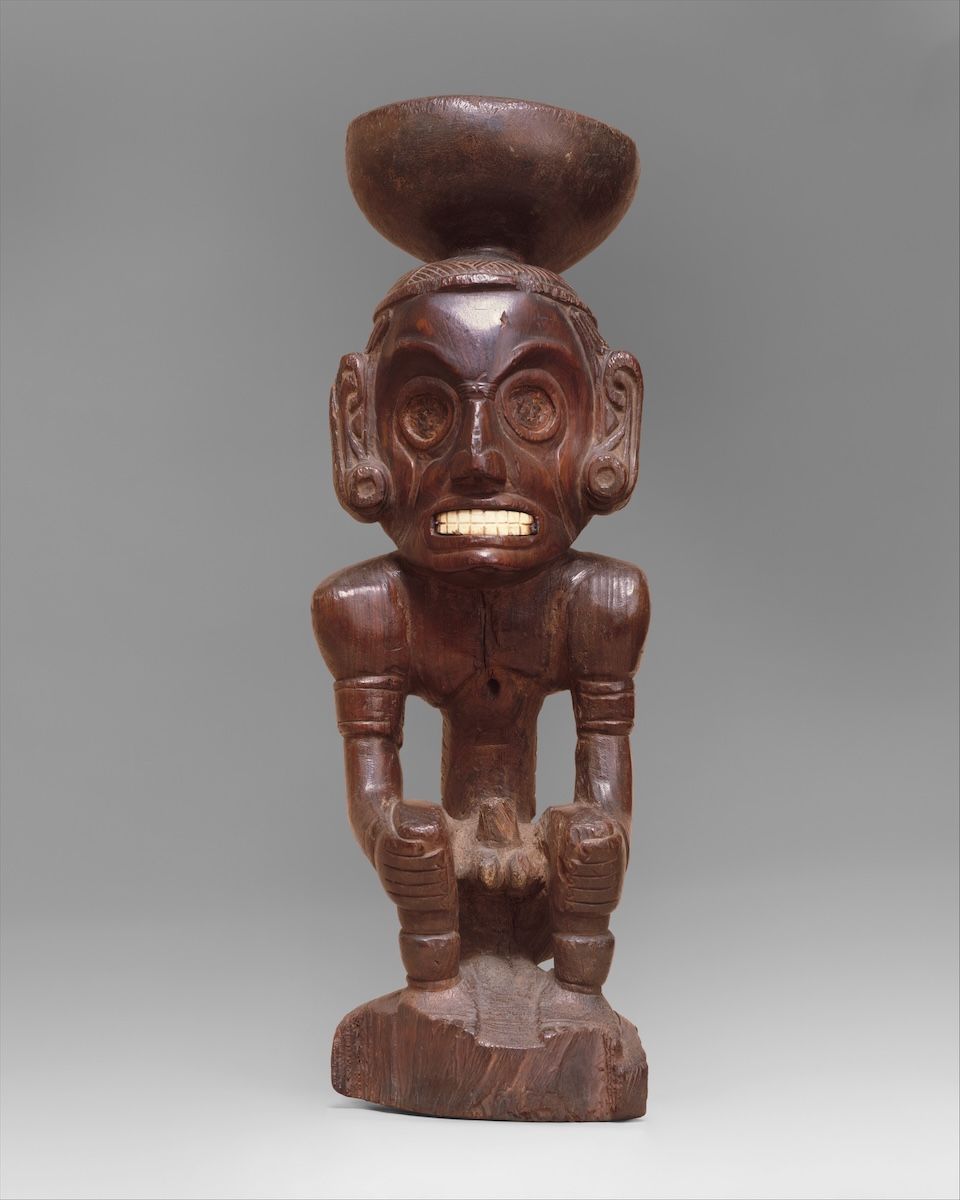
Deity figure (zemí)circa 1000
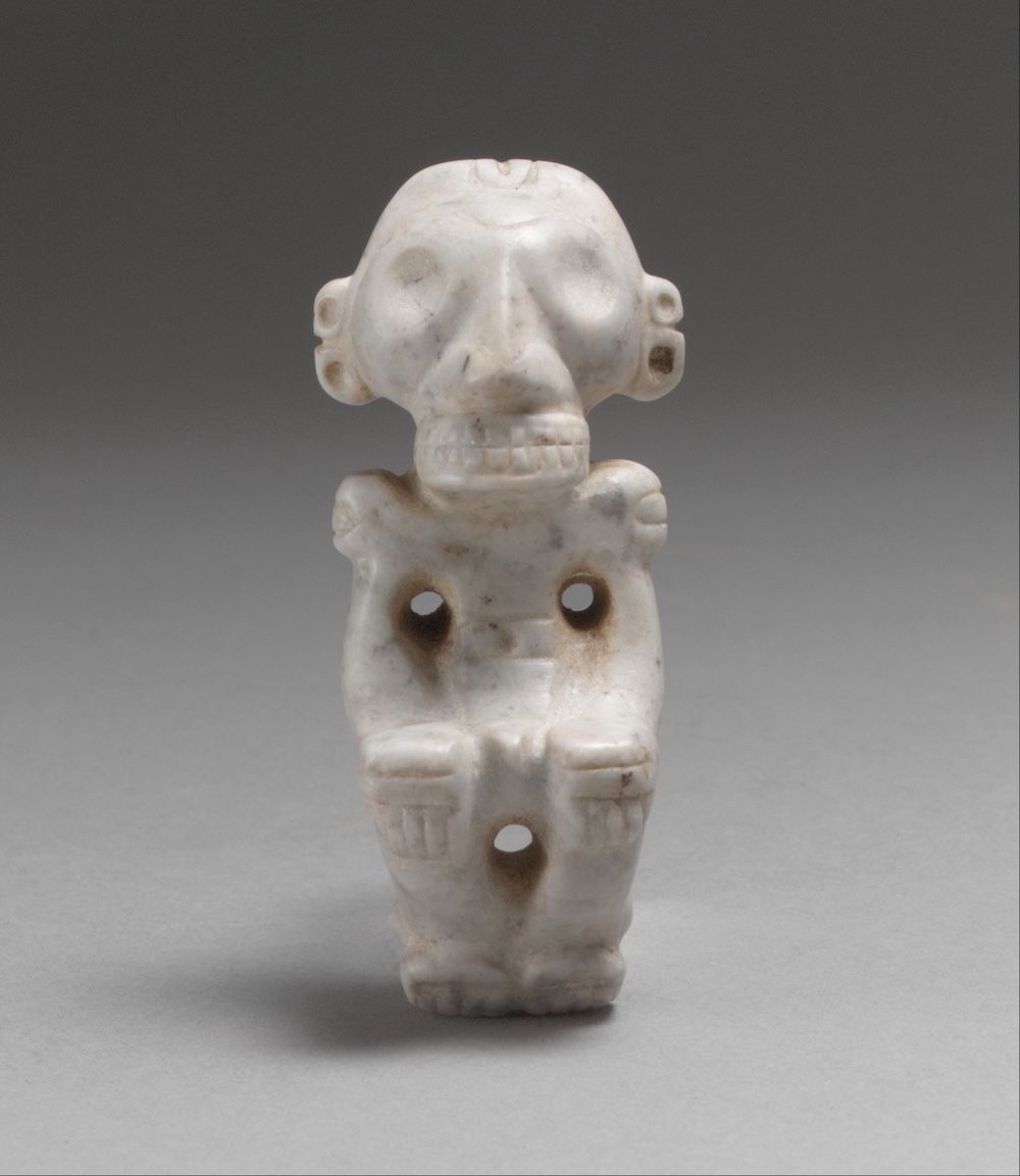
Pendant figure13th–15th century
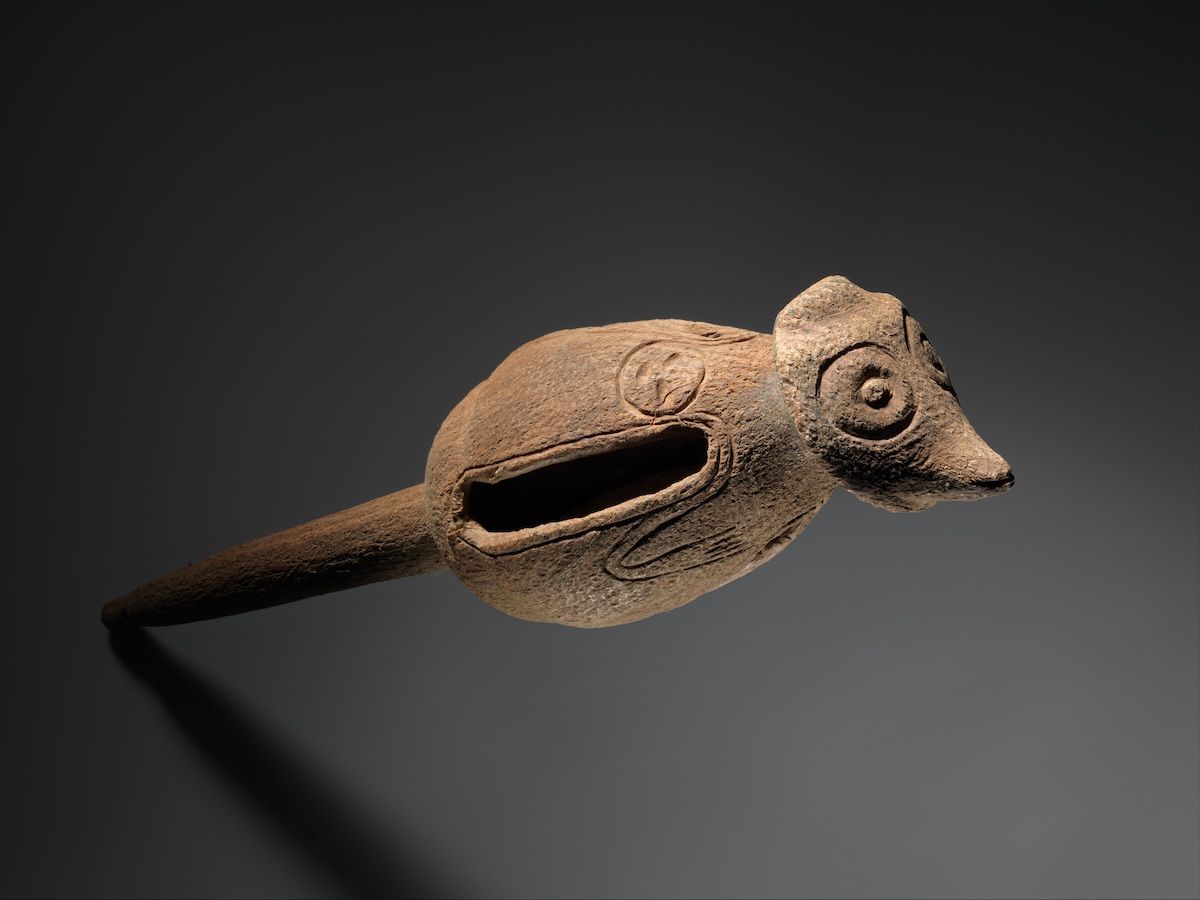
Rattle900–1550
There is an honest problem with picturing this era. None of these objects were dug up on St. Martin. They are Taíno works from the wider Caribbean, held in New York, and they stand in for a world that reached this island without leaving a photogenic record of it. St. Martin's own finds, the Hope Estate pottery and the Norman Estate tools, sit in the Marigot museum and in SIMARC's collections, and the excavations that recovered them are the real picture of Soualiga.
Tell me the story
The island before anybody showed up
Start with the ground itself, before anyone was standing on it.
St. Maarten sits at the top of the Lesser Antilles, in the Leeward Islands, about 150 miles east of Puerto Rico. Geologically it belongs to the Anguilla Bank, a shallow underwater platform it shares with Anguilla and St. Barths. During the ice ages, when sea levels dropped, those three islands were one island. Anguilla, St. Barths, and St. Martin were literally connected.
The island is volcanic in origin, though the volcanoes went quiet a very long time ago. What's left is green rolling hills. Pic Paradis on the French side is the highest point at 424 meters. Mount Flagstaff, at 383 meters, sits right on the border between the two countries, which is fitting.
Two features of this landscape wrote the script for everything that came after.
Feature number one: the salt ponds. The Great Salt Pond behind Philipsburg, plus smaller ponds around the island, took seawater and concentrated it, naturally, into harvestable salt. We live in a world with refrigerators, so salt is just the thing on the table. For most of human history it was how you kept food from rotting, which made it both a survival tool and a currency. This island produced it for free, courtesy of the sun.
Feature number two: the dryness. St. Maarten sits in a rain shadow, so it gets less rain than most of its neighbors. That dryness made the salt ponds work beautifully. It also made large-scale agriculture harder, which shaped the plantation era and eventually pushed the island toward trade and tourism. The geography was setting the terms long before anyone arrived to live under them.
The first St. Martiners
One belief needs correcting right away, because it's everywhere: that the island's history starts with Columbus.
It doesn't. It starts at least five thousand years before he sailed past.
We know this because of decades of archaeology, especially by teams from Leiden University (the work of Corinne Hofman and Menno Hoogland in particular), French research units, and local institutions like the Sint Maarten Archaeological Center, SIMARC, led by Dr. Jay Haviser, and the Hope Estate Archaeological Association on the French side. Thanks to them, St. Martin has one of the best-documented pre-Columbian records in the entire northern Lesser Antilles. More than thirty pre-Columbian sites have been catalogued on this one small island.
Here are the three big chapters of that ancient story.
The Archaic Age: the original beach people (around 3300 BC to 500 BC)
The earliest evidence of humans on St. Martin comes from what archaeologists call Archaic Age sites, mostly on the French side. The famous one is Norman Estate, near Grand Case, dating to about 2000 BC. That was the first pre-ceramic site ever discovered on the island. Others include Etang Rouge and Baie Orientale, and some researchers push the earliest human presence back toward 3300 BC based on the wider regional record.
These were semi-nomadic hunter-fisher-gatherers who arrived by canoe, most likely island-hopping up from South America. They had no pottery and did no farming. What they had was skill, ocean knowledge, and a reef that fed them. Their sites are full of shell middens, which is the technical term for ancient piles of discarded shellfish, along with simple stone tools and the remains of reef fish, conch, and crab.
The most striking finding comes from those shellfish remains. Scientists studied them across eight excavated sites and found that these communities worked the reefs, mangroves, and lagoons expertly for thousands of years, adjusting as the climate and sea levels changed. That is not bare survival. It's deep, inherited knowledge of one specific place, held and passed down for millennia.
The Ceramic Age: the farmers and artists arrive (around 550 BC to 650 AD)
Around 550 BC, give or take, a completely different people arrived, and the island changed.
These were farmers and potters from the Orinoco River delta region of South America. Archaeologists call them the Saladoid culture, named after the Saladero site in Venezuela where their style was first identified. They came in big seagoing canoes. They grew cassava and other crops. They made beautiful painted ceramics, plus tools of stone, shell, and bone. This was a full civilization on the move.
Their main settlement on St. Martin was Hope Estate, up on a plateau overlooking the Grand Case plain, and its importance runs well past the island. It is one of the earliest Ceramic Age village sites in the entire Lesser Antilles, occupied in phases until around 650 AD. It even plays a starring role in a famous archaeological debate called the "La Hueca problem," about how the earliest ceramic traditions spread through the Caribbean. This little island is in the academic literature. Another early village sat at Anse des Pères.
These Arawakan-speaking communities are the people island history usually calls the Arawaks. They lived in villages of sturdy thatched houses built to handle hurricanes, three thousand years before anyone wrote a building code. They farmed, they fished, they traded stone, shell, and pottery across the island chain, and they had rich social and spiritual traditions, including the zemi worship found across the Taíno-Arawak world.
The Late Ceramic Age and the Kalinago (around 650 AD to 1500 AD)
From around the 7th century AD, new coastal villages appear at places like Pointe du Canonnier, Baie Orientale 2, and a big village site called BK76 that was occupied from roughly 700 to 1170 AD. There's even a late Arawak village near Baie Rouge dating all the way to about 1500 AD.
Then, around 1300 to 1400 AD, the Kalinago (Europeans called them Caribs) moved up the island chain from South America and became the dominant people of the Lesser Antilles. The Kalinago world is what gave the island its remembered names: Soualiga, land of salt, and Oualichi, land of women.
One myth needs busting here, because it matters. You may have heard the old story about savage cannibal Caribs wiping out the peaceful Arawaks. Modern scholars don't accept it. There is real doubt that a single large Carib invasion of the northern Lesser Antilles ever happened, and the record looks more continuous and more complicated than the story allows. That caricature was written by the people doing the conquering, which is reason enough to be suspicious of it.
One fact here surprises almost everyone: there is no solid evidence that any Amerindian population was permanently living on St. Martin when Europeans first sailed past in the 1490s. The island may have been used seasonally, for salt and fishing, rather than settled full time. Either way, within a few decades of 1493, Spanish slave raids and European diseases devastated the indigenous peoples of the whole region.
The first St. Martiners live on in the archaeology, in the place names, and in the artifacts on display at the Marigot museum on the French side and through SIMARC's work on the Dutch side. Five thousand years of history, before a single European sail appeared on the horizon.
Go deeperCaveats, sources, and where this account is uncertain
St. Martin has one of the best-documented pre-Columbian sequences in the northern Lesser Antilles, with more than thirty catalogued sites on roughly 34 square miles. That record exists because of sustained excavation by Leiden University teams (Corinne Hofman and Menno Hoogland), French research units including the work of Dominique Bonnissent, and local institutions: SIMARC on the Dutch side, the Association Archéologique Hope Estate on the French side.
Hope Estate is the site of international consequence. It is among the earliest Ceramic Age villages in the Lesser Antilles and a fixture of the "La Hueca problem," the long-running debate over how the earliest ceramic traditions moved through the Caribbean.
The claim that no Amerindian population was permanently resident at European contact is a genuine finding of the archaeology, not a colonial erasure. Seasonal use for salt gathering and fishing is the better-supported reading of the late record.
Handle with care
- The pre-Columbian chronology varies by source. Norman Estate, the first pre-ceramic site found on the island, dates to roughly 2000 BC; the 3300 BC figure comes from the broader regional record rather than a directly dated St. Martin site. Both are cited in good faith by serious researchers. The archaeological literature, Bonnissent's work especially, is the authority, and any specific date given here should be read against it rather than against this page.
- "Around 550 BC" for the Saladoid arrival is itself a range; some sources say 500 BC.
- The popular story of "cannibal Caribs exterminating peaceful Arawaks" is treated with skepticism by modern scholarship. Archaeologists doubt there was ever a single large-scale Carib invasion of the northern Lesser Antilles. The caricature originates with the colonizers, and this page does not repeat it as fact.
- "Arawak" is the name popular island history uses for these Arawakan-speaking communities. Archaeologists more precisely say Saladoid for the Ceramic Age arrivals.
Sources for this era
- Hofman, C.L. & Hoogland, M.L.P. (eds.), Archaeological Investigations on St. Martin (Lesser Antilles): The Sites of Norman Estate, Anse des Pères and Hope Estate, Leiden University (1999)
- Serrand, N. & Bonnissent, D., "Interacting Pre-Columbian Amerindian Societies and Environments: Insights from Five Millennia of Archaeological Invertebrate Record on the Saint-Martin Island," Environmental Archaeology (2018)
- SIMARC, the Sint Maarten Archaeological Center
- Leiden University, Caribbean archaeology research
How St. Martin Got Its Name (1493): Columbus's Mistake
The island is named for a saint famous for cutting his cloak in half to share it, by a man who probably named a different island and never landed here.
Why is the island called St. Martin?
The name honors Saint Martin of Tours, whose feast day (November 11) fell when Columbus passed through in 1493, though historians believe Columbus actually gave the name to Nevis and mapmakers later transferred it to this island.
1597–1599
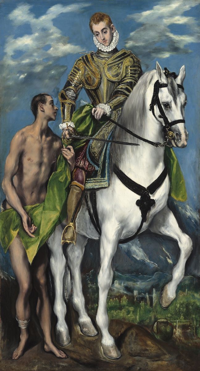
The saint the island is named for, doing the thing he is famous for: cutting his cloak in half to share it with a beggar. El Greco painted it around 1597, on the other side of the Atlantic, with no thought of a 34-square-mile island in the Caribbean. The name arrived here the same way, from a distance, given by people who were thinking about something else.
Tell me the story
November 11, 1493. Christopher Columbus, second voyage, sailing through the northern Lesser Antilles. November 11 happens to be the feast day of Saint Martin of Tours, a 4th-century bishop famous for one thing: cutting his cloak in half to share it with a freezing beggar.
So the island that would one day be cut in half and shared between two nations took its name from the saint who cut something in half and shared it. As foreshadowing goes, that is hard to beat.
There is a complication, though. Naval historians, including the great Samuel Eliot Morison, concluded that the island Columbus actually named San Martín that day was probably Nevis. In the confusion of dozens of poorly charted little islands, Spanish mapmakers later slid the name over to this one. And Columbus never landed here. He never set foot on it.
Which leaves the island with a name given by mistake, honoring a saint who shared, bestowed by a man who never visited.
1584
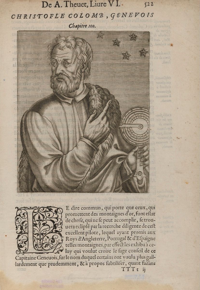
Nobody knows what Columbus looked like. This engraving was published in 1584, seventy-eight years after he died, by an author working from description and imagination. It is one of the oldest surviving images of him and it is a guess, which puts it on roughly the same footing as his claim to have named this island.
130 years of being ignored
For the next 130 years or so, the island was Spanish on paper and ignored in practice. Spain was busy with gold, silver, and the big colonies. San Martín got the occasional passing ship, the occasional salt raid, and a whole lot of quiet. That neglect, the empty space on the Spanish map, is exactly what made everything that came next possible.
1640
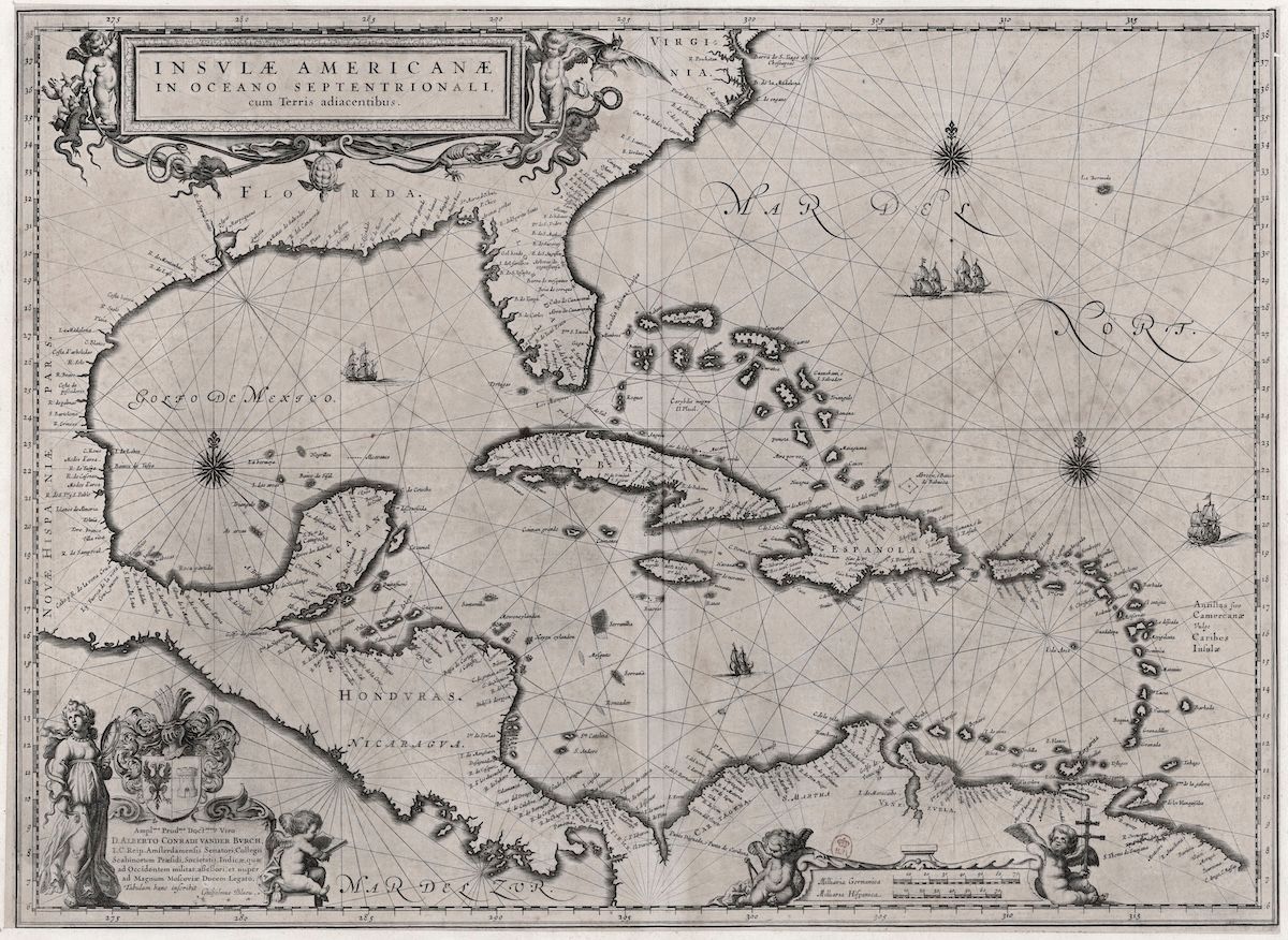
This is the scale of the misunderstanding. On a 1640 Dutch chart of the Caribbean, St. Martin is a speck in a crowd of specks, one of hundreds of islands drawn from sailors' reports, sized by guesswork, and named by whoever got there with a pen. On a map like this one, being ignored for 130 years is close to the default.
Go deeperCaveats, sources, and where this account is uncertain
Tradition says Columbus sighted and named this island San Martín on November 11, 1493, during his second voyage. The historical record is messier. Naval historians, Samuel Eliot Morison chief among them, concluded that the island Columbus named that day was probably the island now called Nevis, and that Spanish cartographers later transferred the name to the present St. Martin amid the confusion of poorly charted small islands.
What is not in dispute: Columbus never landed here. The Spanish claim that followed was nominal. For roughly 130 years Spain concentrated on the gold, silver, and large colonies of the Greater Antilles and the mainland, and San Martín was noted by passing ships, raided occasionally for salt, and otherwise left alone. That vacuum is the precondition for everything after 1620. The Dutch and French did not take the island from Spain so much as walk into a space Spain had declined to fill.
Handle with care
- The Nevis attribution is a scholarly reconstruction, not a documented correction. It is the best-supported reading of the naming, but the popular version, that Columbus named this island, remains what most sources and most signage on the island say.
- "130 years" is a round figure for the span between the 1493 naming and the Dutch and French settlements of roughly 1629 to 1631.
Fort Amsterdam, the Spanish Occupation, and Peter Stuyvesant (1620s to 1648)
Peter Stuyvesant, the future governor of New Amsterdam, lost his leg to a Spanish cannonball on this island in 1644.
Why did the Dutch want St. Maarten?
The Dutch wanted St. Maarten for its natural salt ponds, which supplied their herring industry and global shipping, and for its position between New Amsterdam (New York) and Dutch Brazil.
circa 1660
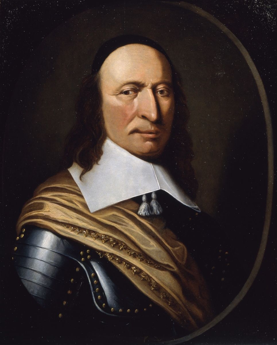
Peter Stuyvesant, painted around 1660, roughly sixteen years after a Spanish cannonball took his right leg on this island. He went on to run New Amsterdam and to lose that too, to the English, who renamed it New York. The wooden leg he wore for the rest of his life he acquired here.
Tell me the story
The Dutch and the French move in
By the 1620s, northern European powers were slipping into every gap Spain left open in the Caribbean. And the Dutch had a very specific problem: they were fighting their Eighty Years' War of independence against Spain, they ran a massive herring industry and a global shipping empire, and both of those things ran on salt.
So when Dutch sailors looked at the Great Salt Pond, what they saw was a warehouse. Add the fact that the island sat conveniently between their colony of New Amsterdam (yes, today's New York) and Dutch holdings in Brazil, and the decision made itself.
Dutch settlers set up around Great Bay by 1631 and built Fort Amsterdam on the peninsula between Great Bay and Little Bay. It was the first Dutch military fort in the entire Caribbean, and it's still there. Around the same time, roughly 1629 to 1631, French settlers connected to the colonization push based on St. Kitts, under the broader movement led by Pierre Belain d'Esnambuc, started occupying the north of the island. Early Dutch life centered on the Cul-de-Sac valley; early French life centered on French Quarter.
Spain takes the island back (1633)
Spain eventually noticed that foreign Protestants were harvesting salt on Spanish-claimed soil, in the middle of a war. In 1633, a Spanish force under the Marquis of Cadereyta captured the island, kicked out the Dutch and French settlers, built what's now called the Old Spanish Fort at Point Blanche, and garrisoned Fort Amsterdam, turning it into Spain's most important stronghold east of Puerto Rico.
The day Peter Stuyvesant lost his leg (1644)
This is one of the best stories in the whole history, because it ties little St. Maarten to New York City permanently.
The Dutch West India Company wanted its salt island back. In March 1644, it sent Peter Stuyvesant, its regional director, with a fleet and reportedly around a thousand men. Stuyvesant landed his troops at Cay Bay, hauled cannons up the heights, and laid siege to the Spanish garrison, which was only about 120 men under Governor Diego Guajardo Fajardo, low on food and lower on morale.
It should have been easy. The Spanish refused to surrender anyway. And during the bombardment, a Spanish cannonball came screaming in and shattered Stuyvesant's right leg. They amputated it below the knee, right there on a ship. In April, after Spanish relief supplies snuck in from Puerto Rico, the Dutch gave up and sailed away.
Stuyvesant recovered, got himself a wooden leg, and went on to become the famous governor of New Amsterdam, the city that became New York. So every time "Peg Leg Pete" Stuyvesant turns up in New York history, remember where the leg went. He left it in a fight over this island, which makes St. Maarten part of New York's origin story.
Spain walks away (1647 to 1648)
By the late 1640s the Eighty Years' War was ending, and Spain did the math: this little island barely paid for itself. The Spanish garrison pulled out in June 1647, and in early 1648 the Spanish came back briefly with Dutch and French laborers to demolish the fortifications before leaving for good.
Here island tradition hands us a beautiful detail. A handful of those laborers, the accounts say five Dutchmen, four Frenchmen, and one man of mixed African and European descent, hid until the Spanish ships disappeared over the horizon. Then the Dutchmen built a raft and made it to St. Eustatius. The Frenchmen reached St. Kitts. Both groups came back with friends to claim the island.
1648 was a hinge year for the whole Western world. The Peace of Westphalia ended the Thirty Years' War and the Eighty Years' War, and Spain finally recognized Dutch independence. But on one small island in the Caribbean, 1648 produced something much smaller and much stranger: a shared home.
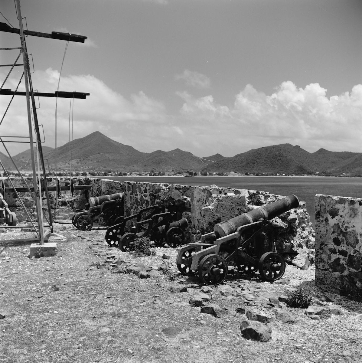
The bastion, looking toward Philipsburg1966
Bastion en gezicht op Philipsburg · Coenraad Liebrecht Temminck Groll · Rijksdienst voor het Cultureel Erfgoed · CC BY-SA 4.0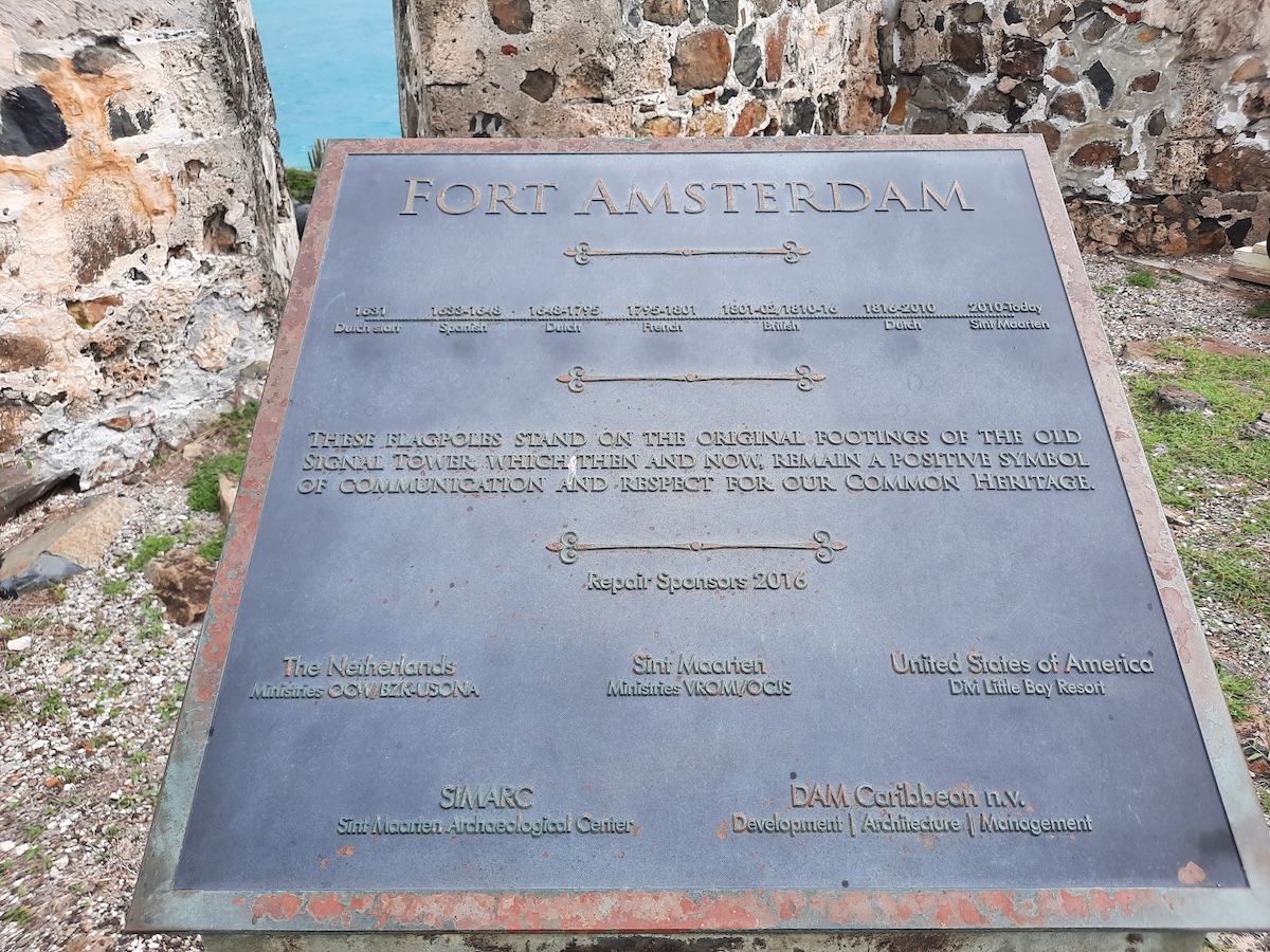
The plaque at the fort2025
Fort Amsterdam (Sint Maarten) 2025 · Ymnes · Wikimedia Commons · CC BY-SA 4.0Fort Amsterdam, the Dutch position of 1631 that Spain took in 1633 and abandoned in 1648, photographed by a heritage surveyor in 1966, and the plaque that stands there now. The plaque lists the sequence: Dutch, Spanish, Dutch, French, British, Dutch, Sint Maarten. The fort changed hands often enough that the island eventually mounted the list on a wall.
Go deeperCaveats, sources, and where this account is uncertain
The Dutch interest in this island was never romantic. The Eighty Years' War against Spain ran on a herring industry that ran on salt, and the Great Salt Pond produced salt for free. The island's position on the route between New Amsterdam and Dutch Brazil sealed the case. Fort Amsterdam, built on the peninsula between Great Bay and Little Bay, was the first Dutch military fortification in the Caribbean and still stands, now also a protected brown pelican colony.
The 1644 siege is well documented. Stuyvesant, then the West India Company's regional director, landed at Cay Bay and besieged a garrison of roughly 120 men under Governor Diego Guajardo Fajardo. Despite short rations and low morale, the Spanish held; a cannonball shattered Stuyvesant's right leg, which was amputated below the knee, and the Dutch withdrew in April after Spanish relief arrived from Puerto Rico. Stuyvesant went on to govern New Amsterdam on his wooden leg.
Spain evacuated the garrison in June 1647 and returned in early 1648 only to demolish the fortifications, the calculation being that the outpost no longer paid for itself as the Eighty Years' War wound down.
Handle with care
- The "around a thousand men" in Stuyvesant's 1644 force is a reported figure that varies between accounts. The Spanish garrison strength of roughly 120 is the more consistently cited number.
- The story of the ten laborers who hid until the Spanish sailed away (five Dutchmen, four Frenchmen, and one man of mixed African and European descent) comes from island tradition rather than a contemporary document. It is a cherished account, and it should be read as such.
- French settlement dates in the north are approximate (roughly 1629 to 1631) and are tied to the St. Kitts colonization networks rather than to a single founding event.
The Treaty of Concordia (1648): Why One Island Has Two Countries
On March 23, 1648, France and the Netherlands split one 34-square-mile island and left the border open. The deal still holds today.
Why is St. Maarten divided between France and the Netherlands?
The island was divided by the Treaty of Concordia, signed on March 23, 1648, after Spain abandoned it; France took the north, the Dutch took the south, and both agreed to an open border and shared resources.
1696
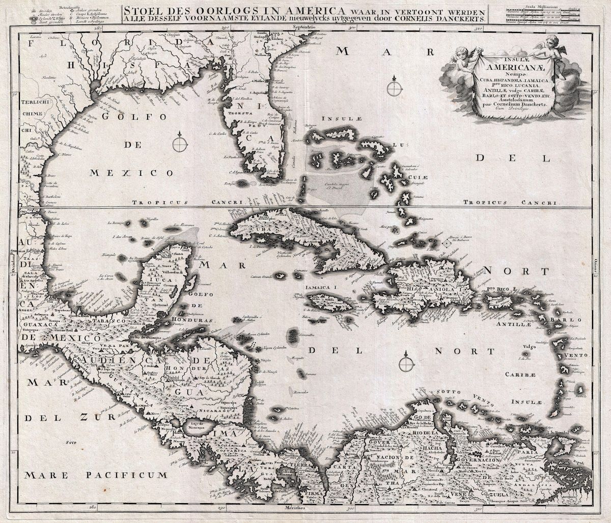
A Dutch chart from 1696, forty-eight years after the treaty, titled in part the Theatre of War in America. That is the neighbourhood St. Martin had just opted out of. Everywhere else on this map, empires were settling their business with fleets. Here, two of them drew a line across an island and agreed to leave the gate open.
Tell me the story
The Spanish are gone. Dutch settlers rush back from Statia, French settlers rush back from St. Kitts, both want the island, and there are skirmishes and raids.
The reality underneath all that, though, was that the total settler population was tiny, probably a few hundred people. Neither side could throw the other off the island. Both were exhausted. Both still had a bigger enemy in Spain. And legend says a French naval squadron sitting offshore helped focus Dutch minds wonderfully.
So instead of fighting it out, they negotiated.
On March 23, 1648, on the hill known ever since as Mount Concordia, Mont des Accords, two local commanders sat down: Robert de Longvilliers for the King of France, and Martin Thomas for the States General of the Netherlands. They signed the Partition Treaty of 1648, known to history and to every St. Martin schoolchild as the Treaty of Concordia.
The deal: France kept the north and the coast facing Anguilla. The Dutch kept the south, including the fort. The French side ended up bigger, about 53 square kilometers to the Dutch side's 34.
The legend of the walking race
And yes, this is where the famous legend comes in. The story goes that a Frenchman and a Dutchman stood back to back and walked the coastline in opposite directions, with the border drawn wherever they met. The Frenchman, they say, was fueled by wine and moved briskly. The Dutchman preferred genever, Dutch gin, and took his time. It's almost certainly not true, and it is still the best border-origin story anyone has come up with. Just label it a legend, because that's what it is.
What actually mattered was the principles
What mattered more than the line on the map were the principles. People from both sides could move freely across the whole island. They'd share the natural resources, including the salt ponds (French-side residents kept the right to harvest and export salt from the Dutch side). They'd trade freely, hunt and fish anywhere, and defend each other against outside attack.
The Treaty of Concordia is one of the oldest treaties still in effect anywhere in the world. It survived every European war since. It survived Napoleon. It survived two World Wars. It survived the complete transformation of both parent countries. The exact boundary took time to settle (it got clarified over the following two centuries, especially in the early 1800s, and tiny adjustments continued into modern times, including a 2023 Franco-Dutch agreement that finally settled the Oyster Pond stretch). But the principle of 1648, one open island, one community, two flags, never broke.
In 1948, on the treaty's 300th anniversary, the Border Monument obelisk went up on the Marigot road, celebrating three centuries of peaceful coexistence. Drive past it and you're passing an agreement older than the United States by more than a century.
2008
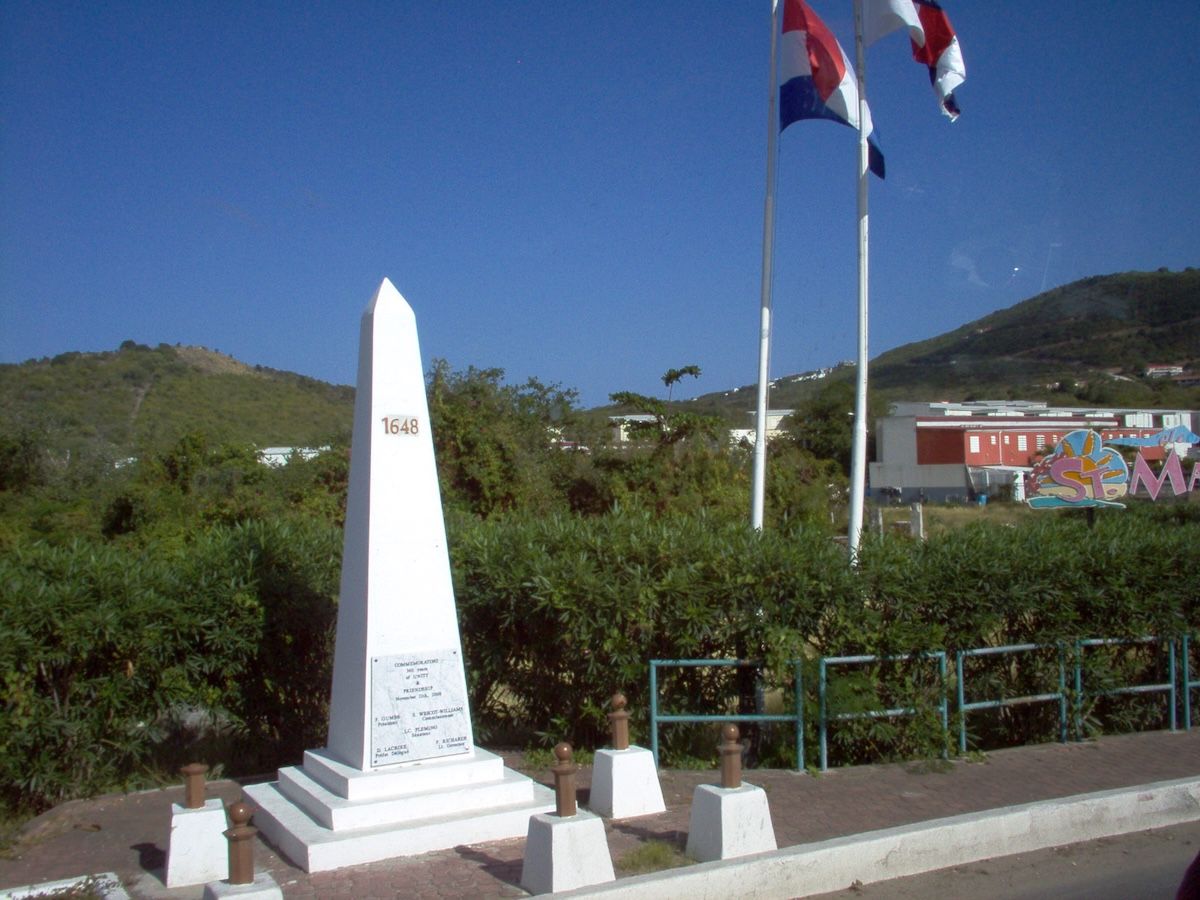
The whole border, in one photograph. An obelisk with 1648 carved on it, two flags, a road that does not slow down, and nobody checking anything. After 376 years the treaty still holds. This monument, and the welcome signs on either side of it, are the whole of the border.
Go deeperCaveats, sources, and where this account is uncertain
The signatories were local commanders, not sovereigns: Robert de Longvilliers for the King of France and Martin Thomas for the States General of the Netherlands. The document is properly the Partition Treaty of 1648; "Treaty of Concordia" is the name it took from the hill it was signed on (Mount Concordia / Mont des Accords).
The partition's principles are what survived: free movement across the whole island, shared natural resources, mutual defense, and French-side rights to harvest and export salt from the Dutch side. The line itself did not settle quickly. It was clarified across the following two centuries, most significantly in the early nineteenth century and by the Franco-Dutch agreement of 1839, and the last ambiguous stretch at Oyster Pond was only resolved by a Franco-Dutch agreement in 2023.
Handle with care
- The walking-race legend (a Frenchman with wine, a Dutchman with genever, walking the coast in opposite directions until they met) is folklore, not history, and should always be labelled as such. It is a post-hoc explanation for the size difference between the two sides (roughly 53 km² French to 34 km² Dutch), not a record of how the boundary was drawn.
- The French naval squadron said to have been sitting offshore during the negotiation comes to us through island tradition rather than the treaty record.
- "One of the oldest treaties still in effect" is the accurate claim. It is not the single oldest, and the boundary it created has been repeatedly clarified, most recently in 2023, even though its principles have held unbroken.
Colonial Wars, John Philips, and the Founding of Philipsburg (1648 to 1816)
The island changed hands roughly 16 times before 1817. The border hasn't moved since 1816.
When was Philipsburg founded?
Philipsburg was laid out in 1733 on the sand isthmus between Great Bay and the Great Salt Pond and named for John Philips, a Scottish commander in Dutch service who revived the island's salt and plantation economy.
1863, after an 1858 survey
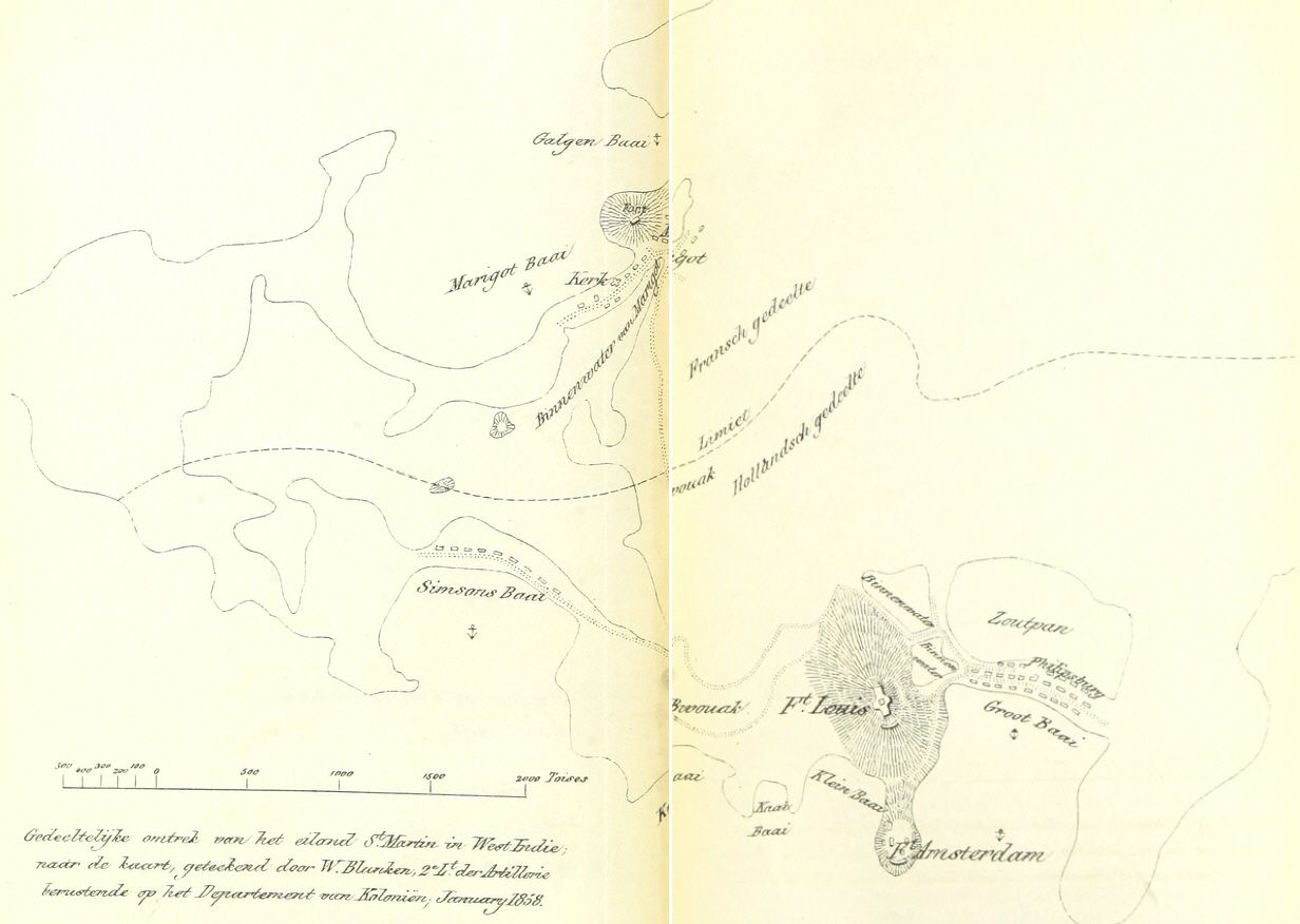
The whole argument on one sheet. Drawn from an 1858 survey and printed in a Dutch book in 1863, this map shows the Fransch gedeelte and the Hollandsch gedeelte divided by a dotted Limiet, with Fort Louis guarding Marigot in the north and Fort Amsterdam guarding Great Bay in the south. Between Philipsburg and the sea sits the Zoutpan, the Great Salt Pond, which is the thing everybody actually wanted.
Tell me the story
Don't get it twisted, though. The treaty kept the French and Dutch of St. Martin at peace with each other. It could do nothing about Europe's wars.
Between 1648 and 1816, as France, the Netherlands, and Britain fought war after war after war, control of parts or all of this island changed hands roughly sixteen times. The island was occupied, raided, traded at peace conferences in Europe like a poker chip, and handed back again and again. Here are the highlights.
The chaotic early years (1650s to 1690s). French and Dutch control wobbled with the Anglo-Dutch Wars and the Franco-Dutch Wars. The British periodically drove out the French, while the Dutch mostly held their southern positions. Around 1690, Marigot got its start as a little fishing and trading village.
John Philips and the birth of Philipsburg (1730s)
The most consequential Dutch-side figure of the 18th century wasn't even Dutch. John Philips was a Scotsman in the service of the Dutch West India Company, and he served as commander of Dutch Sint Maarten from 1735 to 1746. He came in with a plan. He revived the salt industry. He pushed planters into sugar, coffee, and cotton. He opened land to investors. He welcomed English-speaking settlers, who arrived in numbers with enslaved people, and that wave permanently tilted the island's everyday language toward English. That is why St. Martiners speak English to this day.
In 1733, a new settlement was laid out on the sandy strip between Great Bay and the Great Salt Pond. Philips built the first house there in 1735, and the town was named Philipsburg in his honor (formally renamed from "Nieuwe Durp" around 1738). Under his tenure, the island's population grew from roughly 500 to about 2,000. About 1,500 of those 2,000 people were enslaved. The prosperity had a price, and other people were paying it. Philips himself was controversial. At one point he was basically run off the island, and he stubbornly came back. He also finished a new fort at the end of 1737. The town still carries his name.
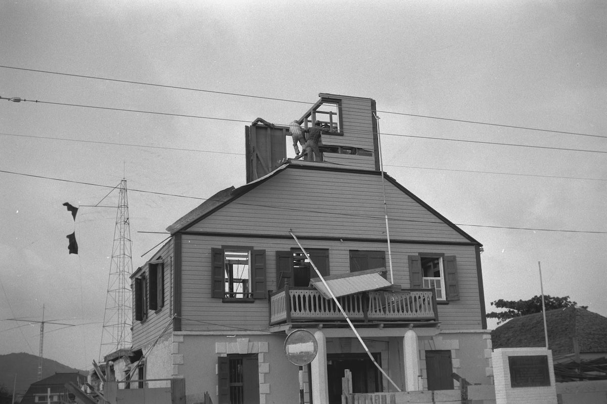
Front1966
Court House, voorzijde · Coenraad Liebrecht Temminck Groll · Rijksdienst voor het Cultureel Erfgoed · CC BY-SA 4.0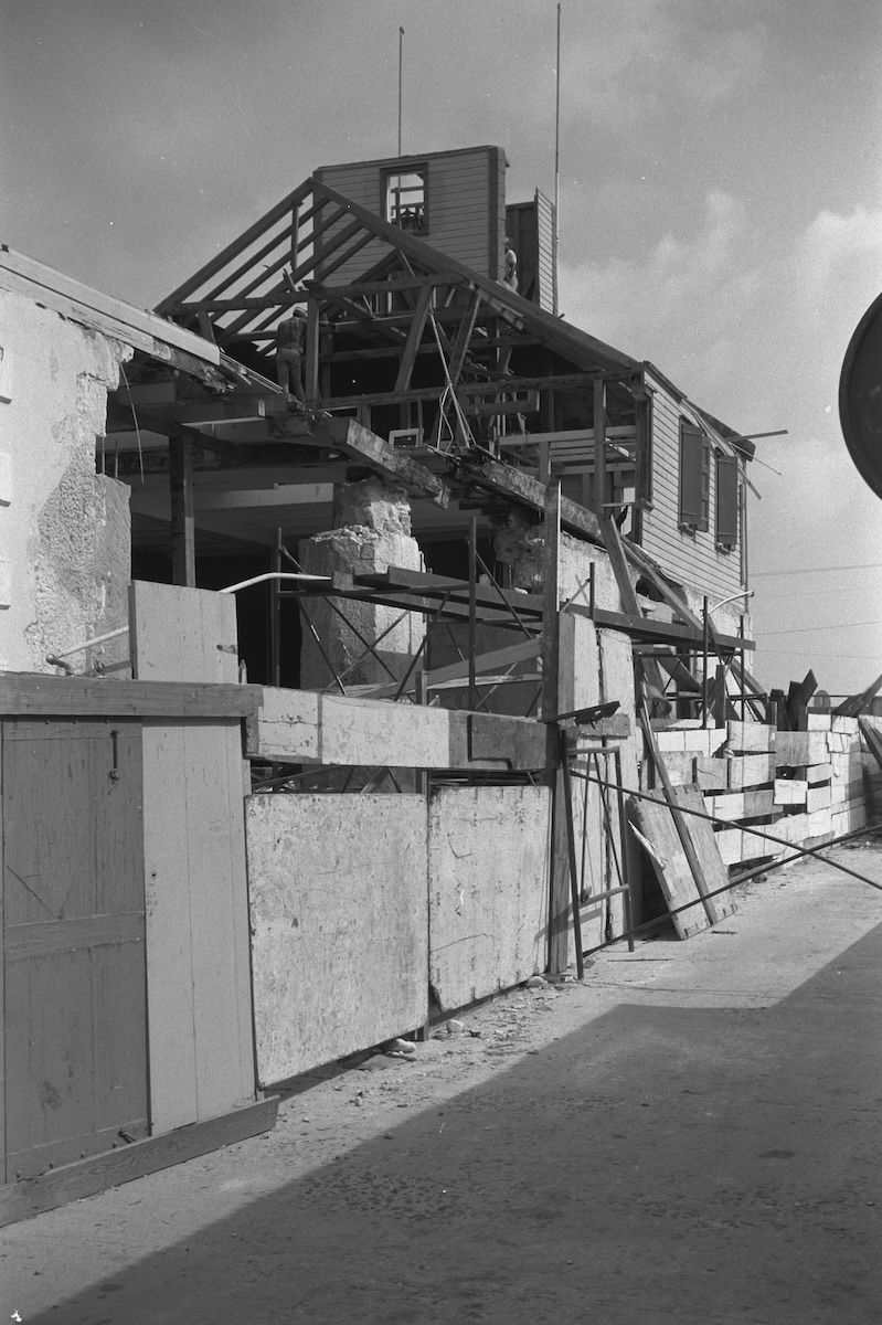
Rear, stripped to the frame1966
Court House, achterzijde · Coenraad Liebrecht Temminck Groll · Rijksdienst voor het Cultureel Erfgoed · CC BY-SA 4.0Philipsburg's Courthouse, built in 1793, photographed in 1966 with its roof off and its frame open to the sky. The date matters. These are pictures of a restoration two hundred years after the building went up, and they are the earliest good look the free archive gives us at how it is put together. The building comes back later on this page, on a flag.
Forts, plantations, and a British admiral
Forts going up everywhere. Fort Louis rose above Marigot under French administration (batteries around 1765, the full fort by 1789) to protect the port's warehouses. Fort Willem above Philipsburg was started by the British in 1801 and taken over by the Dutch in 1816. And in 1793, the Philipsburg Courthouse went up, still the most iconic building on the island.
The plantation peak (around 1790). The second half of the 1700s was the plantation heyday. By about 1790, St. Martin had some 92 estates, sugar leading the way, with cotton, tobacco, coffee, and indigo alongside. A Jewish merchant community flourished in Philipsburg during this era and built a synagogue, abandoned around 1800. Its ruins are still there, behind the Guavaberry Emporium on Front Street, and most people walk past without noticing.
Admiral Rodney arrives (1781). During the American Revolution, Dutch St. Eustatius got rich supplying the American rebels, and Britain was furious about it. In 1781, British Admiral George Rodney sacked Statia, then took Sint Maarten and Saba days later. Britain occupied the island again during the French Revolutionary and Napoleonic Wars, including 1801 to 1802 and 1810 to 1816. A British warship that sank off the coast in 1801 later gave up cargo that's now displayed in the Sint Maarten Museum.
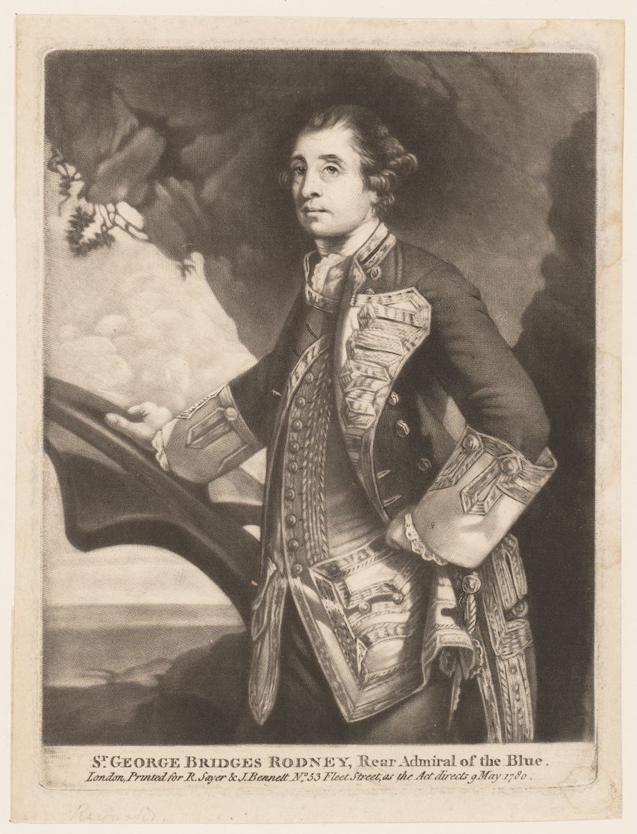
Admiral Rodney1780
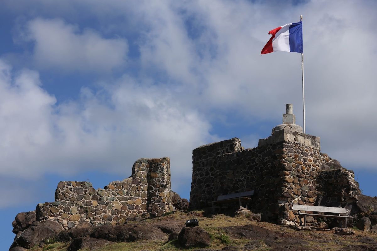
Admiral Rodney, who took the island for Britain in 1781, engraved at the height of his reputation, and Fort Louis above Marigot, which is both what the fighting was over and what is left of it. The forts are ruins with a view now, and the border they were built to argue about has not moved since 1816.
1816: the last handover
With the post-Napoleonic settlements, Britain handed the island back, and the French-Dutch division was confirmed for the last time. The border has not changed sovereignty since 1816, over two hundred years and counting. An 1839 Franco-Dutch agreement tidied up the boundary details.
One administrative note, because it matters later: back in 1763, the French side had been attached to the colony of Guadeloupe, an arrangement that would last, in one form or another, until 2007. The Dutch side was run within the Dutch West Indies, and in 1845 the Dutch Caribbean was organized as the colony of Curaçao and dependencies, six islands: Curaçao, Aruba, Bonaire, Sint Maarten, Sint Eustatius, and Saba.
Go deeperCaveats, sources, and where this account is uncertain
The distinction that matters in this period: the Treaty of Concordia kept the French and Dutch of St. Martin at peace with each other. It had no power over the wars their parent states fought in Europe, and the island was occupied, raided, and traded at peace tables roughly sixteen times between 1648 and 1816.
John Philips is the pivotal Dutch-side figure of the eighteenth century, and the detail most often lost is that he was a Scotsman in Dutch West India Company service, commander from 1735 to 1746. His policy of welcoming English-speaking settlers, who arrived with enslaved people, is the direct cause of the island's English-speaking present, a fact with consequences running all the way to modern education and identity debates on both sides.
The population figure from his tenure carries the era's whole moral weight: growth from roughly 500 to about 2,000, of whom about 1,500 were enslaved.
1816 is the year the sovereignty question closed. The post-Napoleonic settlements returned the island and reconfirmed the French-Dutch division for the last time; the 1839 Franco-Dutch agreement fixed boundary details.
Handle with care
- "Roughly sixteen times" is the conventional count of changes of hands between 1648 and 1816. It is an approximation that depends on whether partial occupations and short-lived raids are counted, and sources vary.
- Philipsburg's founding is a process, not a date: the settlement was laid out in 1733, Philips built the first house in 1735, and the formal renaming from "Nieuwe Durp" came around 1738.
- The 92-estate figure for the circa-1790 plantation peak is the standard number and covers the whole island, both sides.
Slavery and Emancipation on St. Maarten (1648 to 1863): The Road to Freedom
The day after France abolished slavery in 1848, all 26 enslaved people of Diamond Estate walked across the open border to freedom. Legal Dutch abolition took 15 more years.
When was slavery abolished in St. Maarten?
France abolished slavery on the French side in 1848, and enslaved people on the Dutch side effectively freed themselves by crossing the open border, though legal Dutch abolition came only on July 1, 1863.
1849
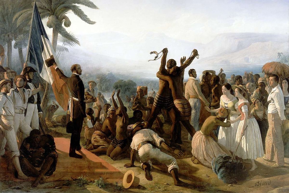
This is the official French picture of emancipation: a commissioner arrives, reads a proclamation, and freedom is handed down to a grateful crowd. Biard painted it in 1849 and it hangs at Versailles. What happened on this island took a different shape. Nobody waited to be handed anything, and the day after the news crossed, twenty-six people at Diamond Estate walked north over the border and freed themselves. The painting records the proclamation. It does not record them.
Tell me the story
This chapter is the moral center of the whole story, and it deserves to be treated that way rather than as a footnote.
For roughly two centuries, this island's economy, the plantations and above all the salt ponds, ran on the forced labor of enslaved Africans and their descendants. Those men, women, and children are the ancestors of most St. Martiners today. The island's culture, language, music, food, and family names all descend directly from them. So this part gets told with respect, and it gets told straight.
The system
The Spanish had brought small numbers of enslaved people in the early 1600s, but mass enslavement arrived with the plantation economy after 1648. Enslaved Africans grew the sugar, cotton, tobacco, coffee, and indigo. They worked the boiling houses. And they did the most brutal job on the island: salt picking. Picture standing for hours in hypersaline brine under a Caribbean sun, breaking and gathering salt crystals that cut your skin and burned in every wound. That was the work.
The enslaved population came to far outnumber the free population. The estate names are still on the map: Belvedere, Diamond, Mary's Fancy, Golden Rock and Industry (which later became the Emilio Wilson Estate in Cul-de-Sac), Loterie Farm on the French slopes of Pic Paradis, Hope Estate, Mount Fortune. Those names are still road signs today.
Undated
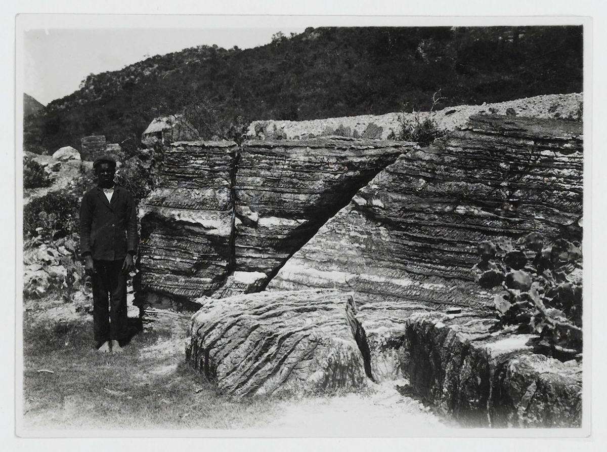
A man stands at a salt pan, beside a rock, for scale. The archive did not record his name, the date, or the photographer. The picture almost certainly postdates emancipation by decades, because the camera reached this island long after 1863. It is still the ground itself. The pans were where the work was done, where people were broken doing it, and where the news that mattered travelled fastest.
The resistance
Enslaved St. Martiners resisted from the beginning. Work slowdowns. Escape into the hills and caves, so common that Dutch authorities passed anti-maroon legislation in 1790 just to deal with runaways. And escape across this island's uniquely porous border and across the water, to islands where freedom came earlier.
The salt ponds themselves became part of that. Enslaved and free workers labored side by side out there, and the ponds turned into an information exchange, where news of abolition in the British, French, Danish, and Swedish territories spread fast. The very site of the suffering doubled as the network.
The island's most beloved symbol of resistance is a woman: One Tété Lohkay. An enslaved woman who repeatedly escaped to the hills. When they caught her, they mutilated her, cutting off her breast as punishment. That's where her name comes from. According to tradition, she escaped again and kept resisting. Her statue stands today on the roundabout at the foot of Sucker Garden Road.
The scale of flight tells its own story. In 1840, the entire enslaved population of three plantations owned by a single Dutch proprietor fled together.
Freedom crossed the border before the law did
Geography and that old 1648 treaty then set up one of the most remarkable emancipation stories in the Americas.
Britain abolished slavery in its colonies in 1834, with full freedom by 1838. That put free soil, Anguilla, five miles away, within sight of the island's northern beaches. Sweden freed the enslaved of St. Barths in 1847. And then the big one: on April 27, 1848, revolutionary France, pushed by the abolitionist Victor Schoelcher, decreed the end of slavery in all French colonies. Emancipation was proclaimed on French St. Martin in May 1848, commemorated today on May 28.
On Dutch Sint Maarten, slavery was still legal. Which produced an absurdity: one island, one side free and one side enslaved, with an open border guaranteed by a two-hundred-year-old treaty running right through the middle.
The enslaved did the math immediately. The day after French emancipation was announced, all twenty-six enslaved people of the Diamond Estate plantation on the Dutch side walked across the border to the French plantation Mount Fortune, where they were recognized as free men and women. The Dutch commander, Johannes Willem van Romondt, wrote to his French counterpart demanding the runaways back. The French commander's reply was simple: anyone who reaches French territory is free.
That correspondence, known as the "Route to Freedom" documents, was inscribed on UNESCO's Memory of the World International Register in 2017, which makes the island's freedom story officially part of the documentary memory of the world. The Diamond 26 are honored on Emancipation Day in Sint Maarten.
Fifteen years late
After that, the system was finished. Facing mass flight and the threat of revolt, Dutch-side slaveholders essentially gave up. From 1848 onward, slavery collapsed in practice on Sint Maarten. Owners released people and started paying wages, because enforcement had become impossible.
Legal abolition in the Dutch colonies, though, didn't come until July 1, 1863. Which means the people of Sint Maarten were legally freed a full fifteen years after they had, in large measure, freed themselves. That is the heart of this chapter. Freedom on this island was not handed down from Europe. The people here walked to it, fled to it, and claimed it years before any law said they could.
Today, Emancipation Day (July 1) on the Dutch side and Abolition Day (May 28) on the French side keep that memory alive, alongside the Salt Pickers monument at the Great Salt Pond and the Emancipation Monument. And after emancipation, as many planters packed up and left, formerly enslaved families were in some cases able to acquire land on or near the old estates. That's the origin of many of today's family lands and district communities.
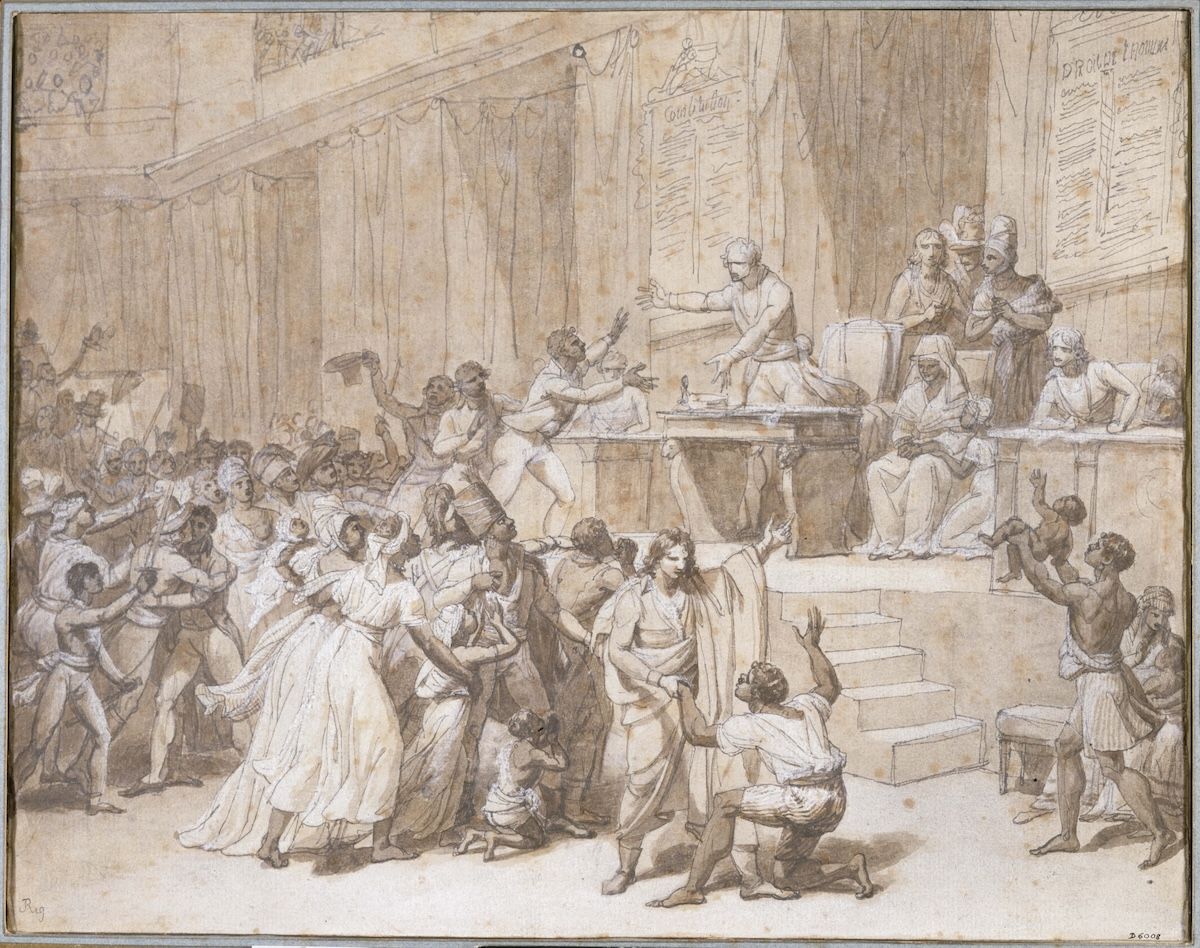
The Convention, 1794circa 1794
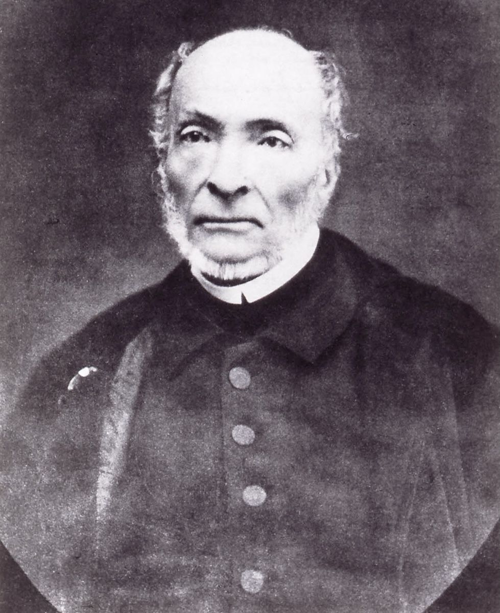
Victor Schoelcher1885
France abolished slavery twice. The first time was 1794, drawn here in the National Convention with the Declaration of the Rights of Man pinned to the wall, and Napoleon reversed it eight years later. The second time was 1848, driven by Victor Schoelcher, photographed here in old age. The law moved in both directions, which is a large part of why the people who crossed the border in 1848 had little reason to trust a proclamation.
Go deeperCaveats, sources, and where this account is uncertain
The self-emancipation of Sint Maarten is the island's most historically significant episode, and it turns on the Treaty of Concordia. An open border guaranteed since 1648 meant that when France abolished slavery in 1848, free soil was a walk away, not a voyage. The Diamond Estate 26 crossed to the French plantation Mount Fortune the day after the proclamation and were recognized as free.
The surviving correspondence is what makes this documentable rather than traditional. Dutch Commander Johannes Willem van Romondt wrote to his French counterpart demanding the return of the runaways; the French commander replied that anyone reaching French territory would be considered free. Those documents, the "Route to Freedom" papers, were inscribed on UNESCO's Memory of the World International Register in 2017.
What followed was collapse in practice rather than by law. From 1848, Dutch-side slaveholders released people and paid wages because enforcement had become impossible with free territory across an open border. Legal abolition in the Dutch colonies came only on July 1, 1863, fifteen years after the people of Sint Maarten had in large measure freed themselves.
The phase-two work that would deepen this era is named work: the van Romondt family papers, the 1863 Dutch emancipation registers digitized by the Nationaal Archief, and French-side état civil records would let this history name people and families, not only events.
Handle with care
- The 1848 dates are commonly conflated and are worth separating carefully. The Schoelcher decree abolishing slavery in all French colonies is dated April 27, 1848. Emancipation was proclaimed on French St. Martin in May 1848. The date commemorated locally as Abolition Day is May 28. All three are correct facts about different events.
- One Tété Lohkay's story (repeated escape, mutilation as punishment, escape again) comes down through tradition rather than the documentary record. She is no less real to the island for that, and her statue at the foot of Sucker Garden Road is a national icon, but the account should be understood as remembered history.
- The Diamond Estate figure of twenty-six people is the number carried by the tradition and the commemoration ('the Diamond 26').
Sources for this era
- UNESCO Memory of the World, "Route to Freedom: A case study of how enslaved Africans gained their freedom on the dual national island of Sint Maarten (Saint Martin)" (inscribed 2017)
- Nationaal Archief (Netherlands): digitized 1863 emancipation registers, Dutch Caribbean
- Sint Maarten Museum, "Slavery and Emancipation"
- St. Maarten National Heritage Foundation
Salt, Decline, and Emigration (1863 to 1939)
Around 1850 this island shipped 330,000 barrels of salt a year to three continents. By 1949, the salt industry was dead and half the population had left.
What happened to St. Maarten's salt industry?
The salt industry peaked around 1850 at more than 330,000 barrels a year, then declined with refrigeration and industrial competition until commercial harvesting on the Great Salt Pond ended in 1949.
1915–1921
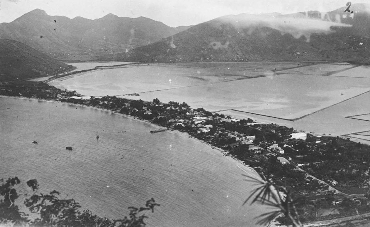
Philipsburg from Battery Hill, somewhere between 1915 and 1921: a thin strip of town on a sandbar, the Great Salt Pond behind it, the sea in front. Everything this island had ever earned came out of that pond. Within a generation the pond stopped paying and half the island's people had left.
Tell me the story
This is the part of the story where everything goes wrong.
Emancipation coincided with, and sped up, economic collapse. Without forced labor, and with European beet sugar undercutting Caribbean cane on world markets, the plantations withered. Sugar was effectively dead by around 1875. Cotton hung on until the early 1930s. The island fell back on the one thing it always had: salt.
Salt seasoned three continents, then died
And for a while, salt boomed. Around 1850, production topped 330,000 barrels a year, and roughly a third of the island's population worked in the industry. St. Martin salt reached Boston, Brussels, and Brazil. Little Soualiga was seasoning food on three continents.
But the work was still grueling, poorly paid labor, now done by free St. Martiners, many of them women. The Salt Pickers monument honors them, and it should. Then refrigeration arrived. Industrial salt production elsewhere got cheaper. Shipping patterns changed. The trade stagnated after the 1920s, and in 1949, commercial salt harvesting on the Great Salt Pond ended for good. The thing that had drawn everyone to Soualiga for a thousand years was finished.
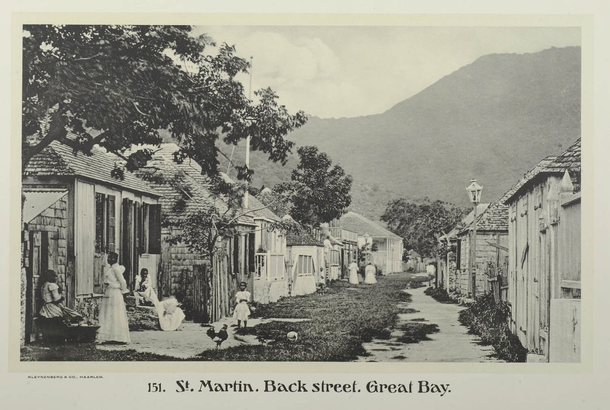
Back Street, Great Baycirca 1913
151. St. Martin. Back street. Great Bay. · Jean Demmeni · Collectie Nationaal Museum van Wereldculturen (RV-A5-3-52) · CC BY-SA 3.0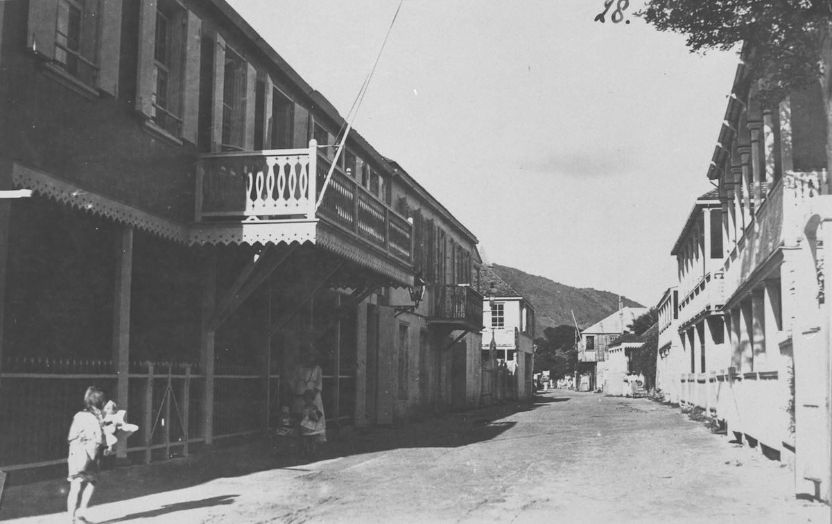
Front Street1915–1921
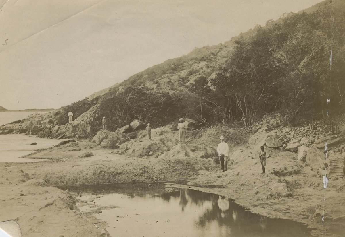
At the salt pansUndated
Zoutpannen op Sint Maarten · Unknown photographer · KITLV / Leiden University Libraries · CC BY 4.0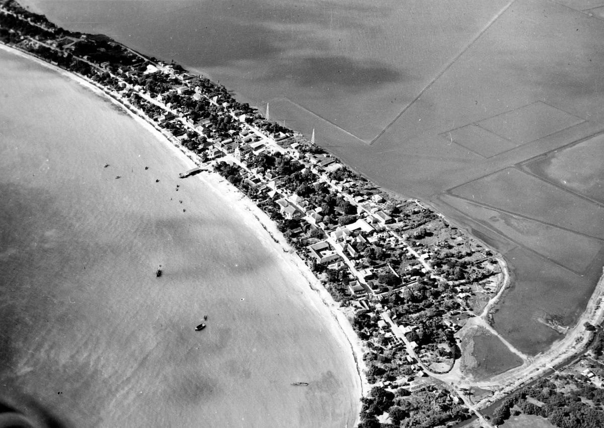
Great Bay from the air, the last year of salt1949
Fifty years of one town, from the archives that bothered to keep it. Two streets and the women standing in them, the pans that paid for everything, and then the whole arrangement photographed from the air in 1949, the last year of commercial salt. Nothing in these frames is about to be rescued. The island has been waiting a long time for something else to happen, and the runway has not been built yet.
The exodus
St. Martiners did what Caribbean people have always done. They moved to where the work was. Waves of emigration: to the sugar estates of the Dominican Republic, to the United States, and above all, from the 1920s onward, to the oil refineries of Curaçao and especially Aruba, where the Lago refinery drew whole St. Martin families. The island's population, about 3,000 in 1914, dropped to roughly 2,000 by the 1940s.
Those who stayed lived by subsistence farming, fishing, livestock, boat-building, and remittances from family abroad. It was a poor island, and a tight one. Self-reliance, mutual aid, family unity across that border: the values that still define St. Martin identity came out of these years, not out of the prosperous ones. So did many of the island's deepest traditions, including the Ponum dance, string band music, johnnycakes and salt fish, and guavaberry liqueur at Christmas.
Two quick admin notes from this era. The French side, attached to Guadeloupe, was governed as a distant, often forgotten commune (though a 1935 decree formalized Dutch-side islanders' freedom to settle on the French side, an echo of Concordia). The Dutch side was governed from Curaçao.
Go deeperCaveats, sources, and where this account is uncertain
This era is where St. Martin identity was made, and the mechanism is worth stating plainly: poverty and emigration, not prosperity, produced the values the island still runs on, namely self-reliance, mutual aid, and family unity across the border. Many of its deepest traditions crystallized here too: the Ponum dance, string band music, the johnnycakes-and-salt-fish culinary canon, guavaberry liqueur at Christmas.
The economic sequence is well established. Emancipation coincided with and accelerated contraction; European beet sugar undercut Caribbean cane, and sugar was effectively finished by around 1875, cotton by the early 1930s. Salt boomed for a period, topping 330,000 barrels around 1850, with roughly a third of the island's population working in the industry and St. Martin salt reaching Boston, Brussels, and Brazil. It was then killed by refrigeration, cheaper industrial production elsewhere, and changing shipping patterns. Commercial harvesting on the Great Salt Pond ended for good in 1949.
The salt pickers of this period were free St. Martiners, many of them women, doing grueling and poorly paid work. The Salt Pickers monument at the Great Salt Pond commemorates them.
The most valuable phase-two material for this era is oral history. The salt-picking generation is gone, but the Aruba-migration generation is still here, and recorded interviews would produce content that exists nowhere else.
Handle with care
- The 330,000-barrel peak is the standard figure for around 1850 and, like most nineteenth-century production numbers, is an estimate rather than an audited total.
- Population figures for this era (about 3,000 in 1914 falling to about 2,000 by the 1940s) are approximations from a period of limited record-keeping, and the emigration that drove them was often circular rather than permanent.
- 1949 marks the end of *commercial* harvesting on the Great Salt Pond, not the end of all salt gathering.
World War II and the Airport That Changed Everything (1939 to 1950)
German U-boats are the reason St. Maarten has an airport. The 1943 airstrip became the island's gateway to the world.
When was Princess Juliana Airport built?
The airstrip was built in 1943 as an Allied military airfield and was opened as a civilian airport by Princess Juliana of the Netherlands on March 4, 1944.
March 1944
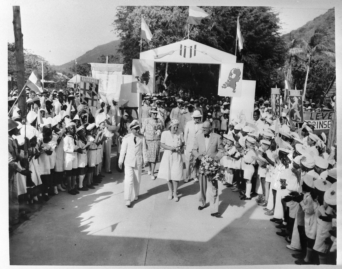
March 1944. Princess Juliana walks through Philipsburg between what looks like every schoolchild on the island, under an arch built for the occasion and hung with the arms of the Dutch provinces. There is a war on, the Netherlands is occupied, and the U-boats are out there. The airstrip that the war had just handed the island was only months old.
Tell me the story
Two decisions between 1939 and 1943 quietly rewrote this island's future, and neither one was made with that future in mind.
Decision one: free port status (1939). The Dutch side abolished all import and export duties, making Sint Maarten a duty-free port. At the time it was a modest move to help a depressed economy. In hindsight it was the foundation stone of the entire shopping-and-tourism economy, and nobody knew it yet.
Then the Second World War arrived
Germany occupied the Netherlands in May 1940, and the Dutch Caribbean carried on under the Dutch government-in-exile. France fell weeks later, and French St. Martin came under Vichy-aligned administration, blockaded by the Allies. Early in the war, the French even briefly controlled the whole island for about ten days. Meanwhile, German U-boats were hunting ships all over the Caribbean, and the Allies needed airfields up and down the island chain.
Decision two: the airstrip (1943 to 1944)
In 1943, the Americans built a military airstrip on the flat land by Simpson Bay Lagoon, part of the Allied anti-submarine and air-ferry network. On March 4, 1944, Princess Juliana of the Netherlands officially opened it as a civilian airport, and it took her name.
Put that in perspective. For its entire history, this island's connection to the world had been the sea: slow, limited, at the mercy of wind and war. Then, almost overnight, because of submarines and a world war, St. Maarten got a runway. Wartime trade with the United States surged, English and American influence deepened, and the island was suddenly four flight-hours from the biggest consumer market on Earth.
Almost nobody realized it at the time, but that airstrip in the old salt flats was the single most important piece of infrastructure ever built on St. Martin. Everything modern about this island comes through that runway.
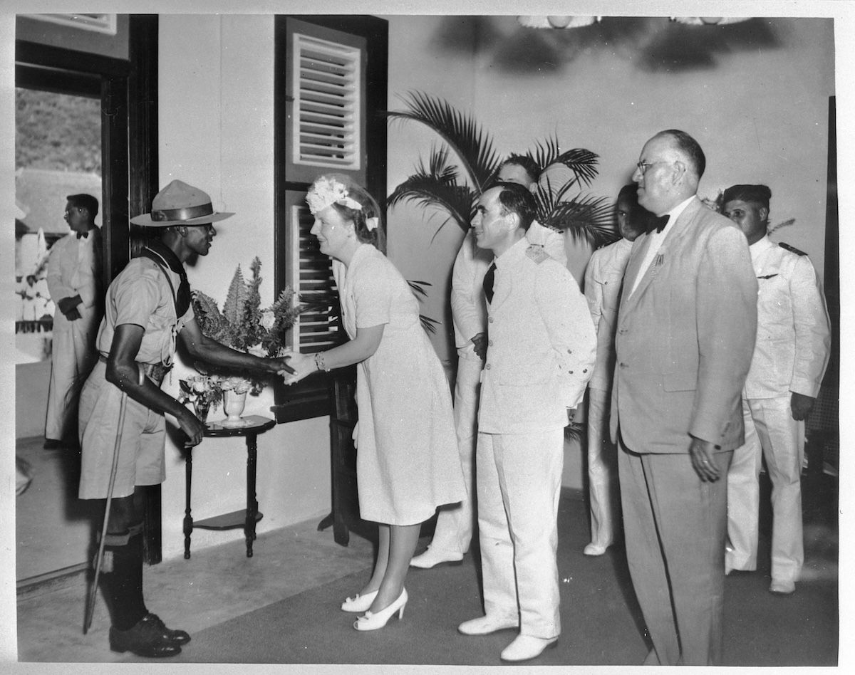
The receiving line1944
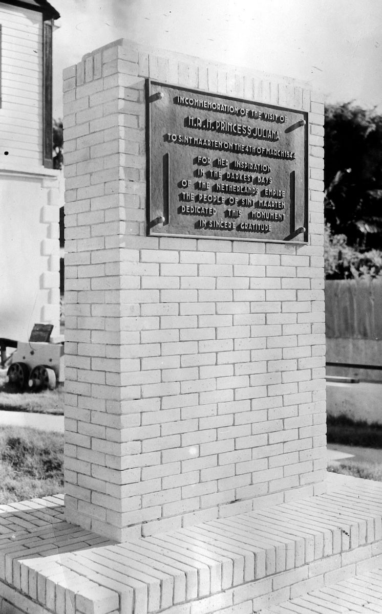
The monument, three years later1947
The handshake, and what the island built to remember it by. The monument's wording runs: erected by the people of Sint Maarten, in sincere gratitude, for her inspiration in the darkest days of the Netherlands Empire. That is how the relationship was phrased in 1947. In 2010 the island voted itself a country.
Go deeperCaveats, sources, and where this account is uncertain
Two decisions in the 1939–1943 window account for most of what the island became, and neither was made with tourism in mind.
Free port status in 1939, the abolition of import and export duties on the Dutch side, was a modest measure for a depressed economy. It became the foundation of the shopping-and-tourism economy decades later.
The 1943 airstrip at Simpson Bay Lagoon was built as a military airfield in the Allied anti-submarine and air-ferry network, a direct response to German U-boat activity in the Caribbean. Princess Juliana of the Netherlands opened it as a civilian airport on March 4, 1944, and it took her name. The strategic reading is that for its entire prior history the island's link to the world was maritime; the runway replaced a sea connection with an air connection to the largest consumer market on earth, four flight-hours away.
The wartime split is worth noting for what it says about the border. The Dutch side carried on under the government-in-exile while the French side came under Vichy-aligned administration and Allied blockade: two halves of one island on opposite sides of a world war, with the Concordia border still open between them.
Handle with care
- The roughly ten days of French control over the whole island early in the war is a small and inconsistently documented episode.
- The airstrip is generally credited to American construction within the Allied network; accounts of the division of labor vary.
The Tourism Boom and the Wathey Era (1950 to 1995)
An island of 5,000 people became home to 60,000 in one generation, and over 100 nationalities today.
How did St. Maarten become a tourist destination?
Duty-free status (1939), the airport (1943), and aggressive development under Claude Wathey from the 1950s turned St. Maarten into one of the busiest tourism destinations in the Eastern Caribbean.
1964
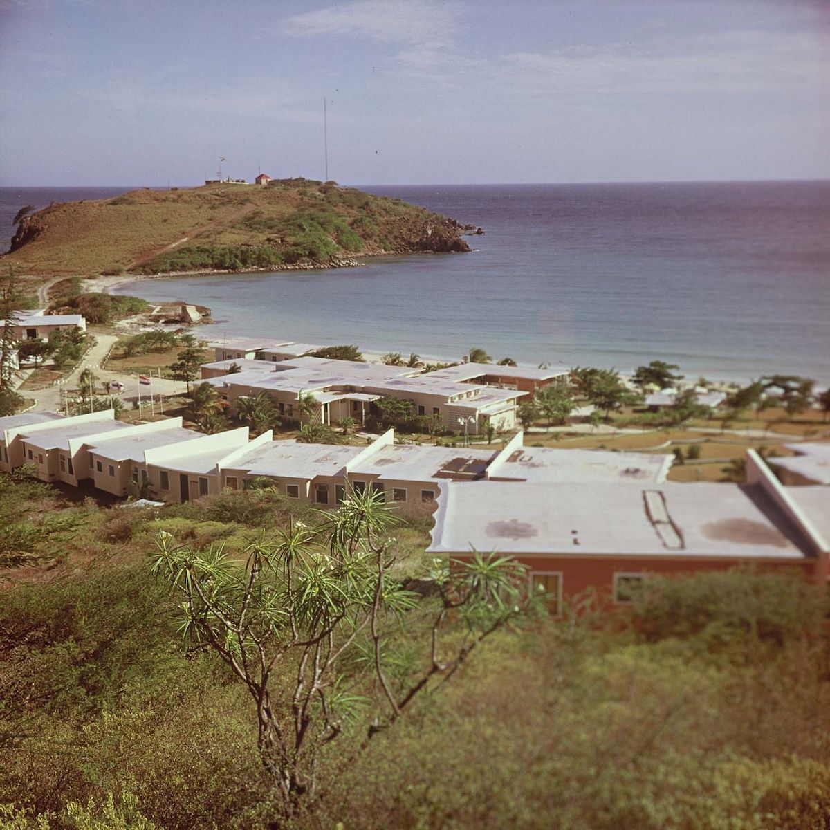
The Little Bay Hotel in 1964, the island's first real resort: low white blocks laid out on an empty headland under Fort Amsterdam, with almost nothing around it. The flights, the cruise ships, the sixty thousand people and the hundred nationalities all start with this building and the runway that fed it.
Tell me the story
The takeoff
By 1950, everything the island needed was already in place: a duty-free port, an airport four hours from New York, thirty-seven beaches among the finest in the Caribbean, a multilingual population, and a postwar America falling in love with the tropics.
The Dutch side moved first. The Sea View hotel welcomed guests in 1947. The first major resort, Little Bay, opened in 1955. The first local radio station started broadcasting in 1959. Through the '60s and '70s, Caribair, Eastern, and Pan Am joined KLM and Air France on the tarmac. Banks arrived. Roads got paved. In 1964, the modern Princess Juliana International Airport terminal opened at its current Simpson Bay location. In 1966, Philipsburg itself was expanded by filling in part of the Great Salt Pond, so the town literally grew on top of the old salt economy.
The French side developed later, mainly from the 1970s, then exploded in the 1980s when French tax-incentive laws, defiscalization, set off a construction boom around Marigot, Grand Case, Orient Bay, and the Lowlands.
Claude Wathey: The Leader
You cannot tell the story of modern Sint Maarten without Claude Wathey (1926 to 1998). "The Old Man." "The Leader." Head of the Democratic Party, and from the 1950s into the early 1990s, the dominant political force on the Dutch side.
Wathey ran an aggressive open-for-business playbook: court foreign hotel and casino investment, expand the airport and the cruise facilities, build the roads, the utilities, the schools. By the numbers, the results were staggering. A sleepy island of a few thousand people became one of the busiest tourism destinations in the Eastern Caribbean, with Princess Juliana among the region's busiest airports and Philipsburg among its top cruise ports.
The other half of the record deserves the same directness. The growth came with weak planning and real environmental cost, and Wathey's era carried persistent allegations of cronyism and corruption. A 1978 Netherlands Antilles commission documented governance problems that went unaddressed. In 1990, prosecutors investigated alleged ties between the island government and Sicilian Mafia-linked investors. A 1991 audit called the island's administration ailing, and the Dutch imposed a period of higher supervision in the early '90s. Wathey himself was eventually convicted of perjury in a corruption-related trial.
And yet his name is on the legislative hall, the main square in Philipsburg, and the cruise pier. Most St. Martiners hold both truths at once: the man built the modern island, and the building came with a bill. Both things are true, and an honest history says both.
The island fills up
Tourism triggered one of the fastest population booms anywhere in the Caribbean. The Dutch side alone grew from roughly 5,000 to 7,000 people around 1970 to more than 30,000 by 1995, with the whole island passing 60,000 by the mid-'90s and sitting around 77,000 to 80,000 in recent years.
Workers came from everywhere. The English-speaking islands: Anguilla, St. Kitts and Nevis, Dominica. Haiti. The Dominican Republic. Curaçao and Aruba, including St. Martiners coming home. Plus communities from the United States, Europe, India, China, and the Middle East. Today, over a hundred nationalities live on this island, and on any given street you'll hear English (the true common tongue and the native language of St. Martiners), French, Dutch, Haitian and French Antillean Creole, Spanish, and Papiamento.
There's a hard fact sitting inside all that growth: native-born St. Martiners became a minority on their own island. It carries deep and continuing consequences for politics, culture, and identity, and any honest telling of the story has to name it.
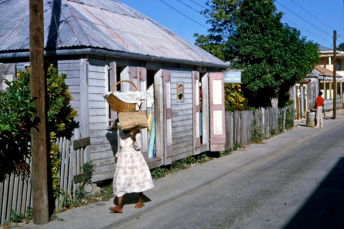
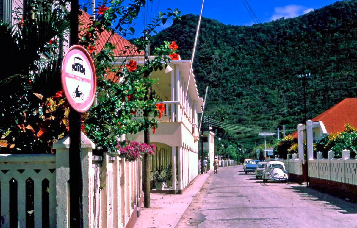
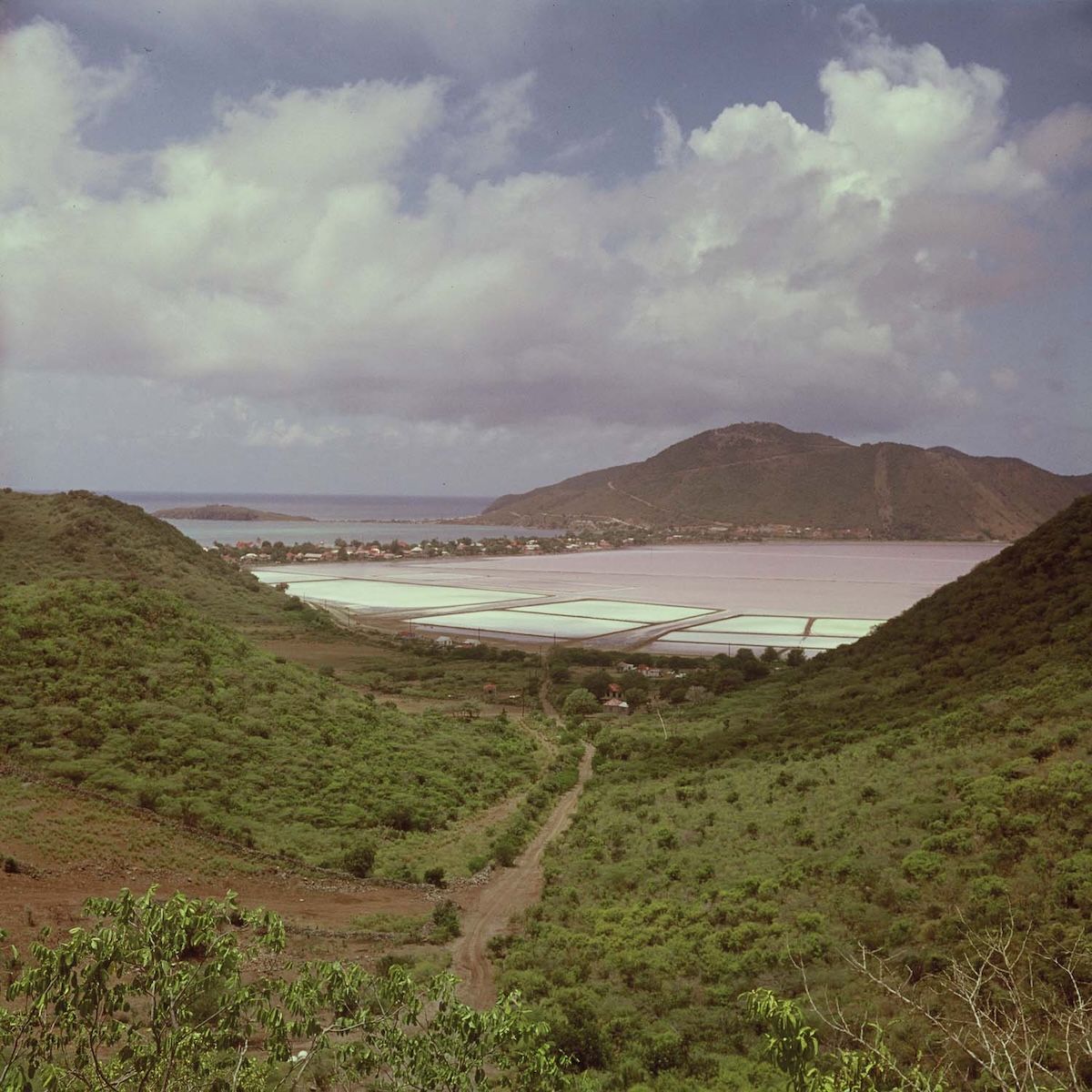
The Salt Pond, fifteen years after the last harvest1964
Gezicht op de zoutpannen 'Salt Pond' en de hoofdstad Philipsburg · Boy Lawson · Collectie Nationaal Museum van Wereldculturen (TM-20017489) · CC BY-SA 3.0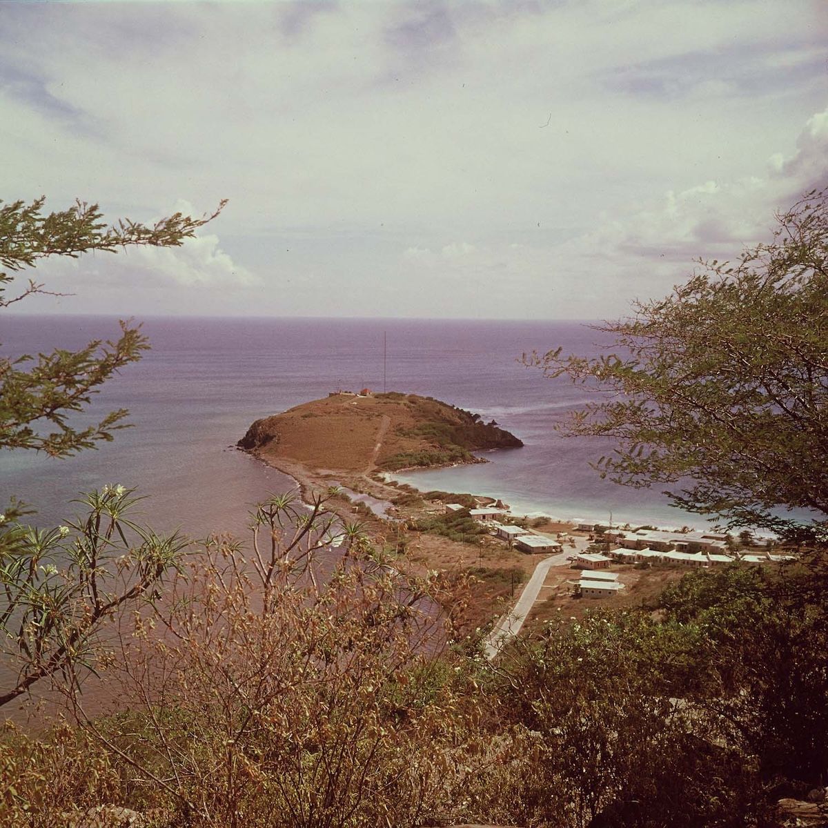
Fort Amsterdam and Little Bay1964
Gezicht op het schiereiland Fort Amsterdam en Little Bay Hotel, gezien vanaf St. Peters Hill · Boy Lawson · Collectie Nationaal Museum van Wereldculturen (TM-20017525) · CC BY-SA 3.0The island in colour, at the hinge. In these years Philipsburg is still a small town that happens to have a hotel, and the shift to a destination that happens to have a town has not finished yet. The salt pond is still there in 1964, fifteen years after the last commercial harvest, drained and quiet and about to become real estate.
The paperwork was changing too
While the hotels went up, the constitutional ground was shifting. On the Dutch side: in 1954, the Charter for the Kingdom of the Netherlands (the Statuut) made the Netherlands Antilles an autonomous country within the Kingdom, with Sint Maarten grouped in the Windward Islands territory with Saba and Statia. In 1983, Sint Maarten became a separate island territory with its own island council. In 1986, Aruba walked out of the Antilles for separate status, and Sint Maarten watched very closely. By 1989, Wathey was openly advocating separation, even independence.
On the French side: St. Martin remained a commune of Guadeloupe, which became a full French overseas department in 1946, administered from Basse-Terre, hundreds of kilometers away. That remoteness bred a frustration that would eventually boil over into change.
Go deeperCaveats, sources, and where this account is uncertain
Wathey's legacy is genuinely contested, and an honest history says so rather than choosing a side. The record on both halves of it is documented.
The achievement: from the 1950s into the early 1990s he drove an open-for-business strategy (foreign hotel and casino investment, airport and cruise expansion, roads, utilities, schools) that made a sleepy island of a few thousand into one of the busiest tourism destinations in the Eastern Caribbean.
The bill: weak planning and environmental cost, plus a documented governance record. A 1978 Netherlands Antilles commission identified problems that went unaddressed; in 1990 prosecutors investigated alleged ties between the island government and Sicilian Mafia-linked investors; a 1991 audit found the administration ailing, leading to Dutch-imposed higher supervision in the early 1990s; and Wathey was ultimately convicted of perjury in a corruption-related trial. His name is nonetheless on the legislative hall, the main square, and the cruise pier.
The demographic fact this era produced, that native-born St. Martiners became a minority on their own island, is not incidental detail. It is the root of continuing consequences for politics, culture, and identity, and it belongs in any serious account.
Handle with care
- Population figures in this era are best read as ranges. The Dutch side grew from roughly 5,000–7,000 around 1970 to more than 30,000 by 1995; the whole island passed 60,000 by the mid-1990s and sits around 77,000–80,000 in recent years. Census methods differ across the two sides, and undocumented residents are by definition undercounted.
- The "over a hundred nationalities" figure is widely cited by both governments and is an approximation.
- Wathey's perjury conviction was in a corruption-related trial; it is not the same thing as a conviction for the corruption itself, and the distinction matters.
Country Status and the Collectivity (2000 to 2010): 10-10-10
Both halves of the island rewrote their relationships with Europe within one decade, by vote.
When did Sint Maarten become a country?
Sint Maarten became a constituent country of the Kingdom of the Netherlands on October 10, 2010 ("10-10-10"), when the Netherlands Antilles was dissolved, following a 2000 referendum; the French side became a separate French overseas collectivity in 2007.
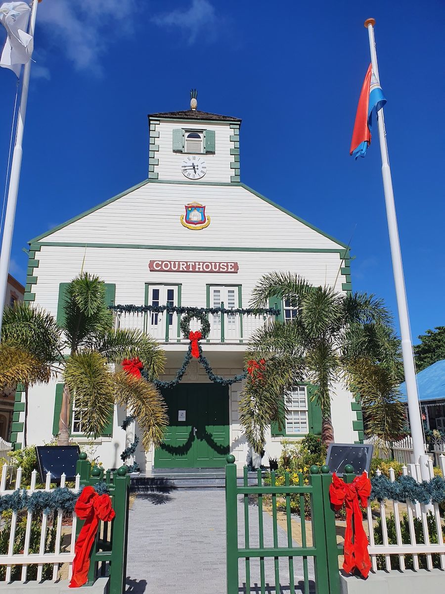
The Courthouse, PhilipsburgUndated
Constitutional Court of Sint Maarten · MyrandaMulder · Wikimedia Commons · CC BY-SA 3.0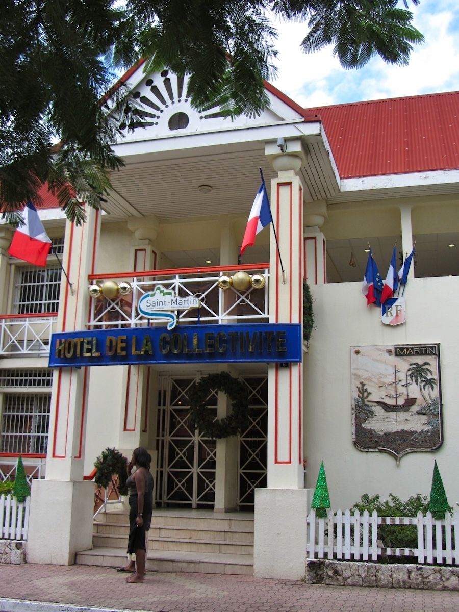
Hôtel de la Collectivité, Marigot2011
Hotel de la Collectivite · Richie Diesterheft · Wikimedia Commons · CC BY-SA 2.0The decade in two front doors. On the left, the Courthouse in Philipsburg, the same 1793 building that appears earlier on this page with its roof off and its frame open to the sky, now flying the flag of a country and housing the Constitutional Court that the 2010 constitution created. On the right, the Hôtel de la Collectivité in Marigot, seat of a French overseas collectivity since 2007. Two halves of one island, both of which spent this decade renegotiating with Europe, and both of which did it by vote.
Tell me the story
While the cranes and the storms were doing their thing, both sides of the island were quietly renegotiating their relationships with Europe. This chapter has some government structure in it, and it's where the modern island gets its shape.
The storms that framed the decade
First, the weather, because it never stops being part of this story. On St. Martin, a hurricane is not an interruption to history. It's one of the forces that makes it, as real as any empire. The island sits square in the Atlantic hurricane belt, and every generation of St. Martiners has a defining storm.
Hurricane Donna, September 1960. Devastated the island (and flattened neighboring Anguilla) in an era with no building codes and barely any emergency infrastructure. Recovery took years and pushed more emigration.
Hurricane Luis, September 5 and 6, 1995. The worst since Donna. A Category 4 monster that crawled past the island, battering it with sustained winds around 135 mph for roughly 24 hours straight. Luis wrecked the marinas and Simpson Bay Lagoon (hundreds of boats destroyed), damaged or destroyed a huge share of homes and hotels, and killed more than a dozen people island-wide. Then Hurricane Marilyn came through within days. The rebuild after Luis reshaped the island's modern hotel stock.
Hurricane Lenny, November 1999. Came in on a freak west-to-east track, the wrong-way hurricane, and dumped catastrophic rain and flooding.
Add Bertha (1996), Georges (1998), José (1999), Omar (2008), Earl (2010), and Gonzalo (2014) to the ledger.
The culture reflects all of it: the shutter rituals, the cisterns, the shared vocabulary of preparation, and a collective identity organized around rebuilding. "Build back better" was a lived St. Martin ethic long before it became anybody's slogan.
The Dutch side: the long road to country status
Sint Maarten had long been frustrated inside the Netherlands Antilles, a five-island federation (after Aruba left in 1986) dominated politically by Curaçao. A 1994 referendum didn't yet show a majority for separation. But on June 23, 2000, a new referendum delivered a clear verdict: roughly 69 percent voted for status aparte, meaning Sint Maarten as an autonomous country within the Kingdom of the Netherlands.
Then came years of negotiation: a Round Table agreement in 2005, a planned 2008 transition that slipped. And finally, the date every St. Martiner knows: October 10, 2010. Ten-ten-ten. The Netherlands Antilles was dissolved, and Sint Maarten became a constituent country of the Kingdom, constitutionally equal to the Netherlands, Aruba, and Curaçao. Its own constitution (adopted unanimously by the island council in July 2010). Its own 15-seat Parliament. A governor representing the Dutch monarch (Eugene Holiday was the first). Full autonomy in internal affairs, with the Kingdom handling defense and foreign relations. Bonaire, Statia, and Saba took a different road, becoming special municipalities of the Netherlands. October 10 is now Constitution Day, celebrated every year. (And a long-promised piece of the deal, a new joint currency called the Caribbean guilder, finally replaced the old Netherlands Antillean guilder in circulation on March 31, 2025, fifteen years later.)
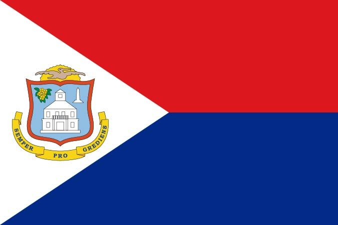
The flag, and the courthouse on itAdopted 1985
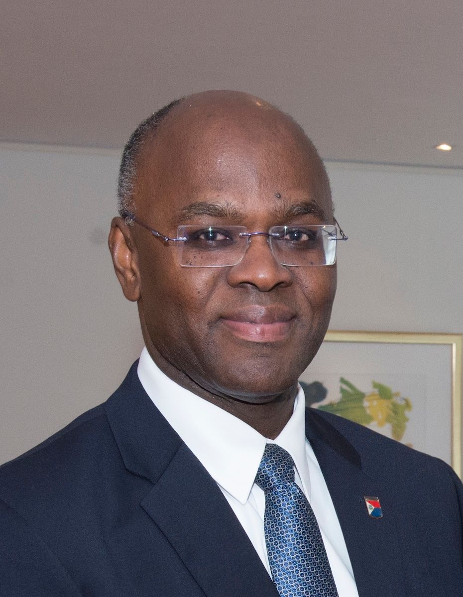
Eugene Holiday, first Governor2015
Eugene Holiday · Ministerie van Buitenlandse Zaken · Wikimedia Commons · CC BY-SA 2.0The white building with the cupola on the shield is the Philipsburg Courthouse, the one from 1793, the one photographed in pieces in 1966. When Sint Maarten became a country on 10-10-10 the arms it flew already carried that courthouse, and the motto underneath reads Semper Progrediens, ever progressing. Eugene Holiday was sworn in as the country's first Governor that day and served until 2022.
The French side: breaking up with Guadeloupe
French St. Martiners had their own grievances with being ruled from Guadeloupe, and France's 2003 constitutional reform opened a door. On December 7, 2003, in a referendum, 76 percent of French-side voters said yes to separating from Guadeloupe and becoming a separate overseas collectivity under Article 74 of the French Constitution. The Collectivity of Saint-Martin was formally born on February 22, 2007, with its institutions running from July 2007: its own elected Territorial Council and President, and expanded local powers over taxation, urban planning, tourism, and more, while remaining part of France and, importantly, remaining an outermost region of the European Union, using the euro.
Which gives us one of the island's best quirks. The French side is in the European Union. The Dutch side is only an EU overseas territory. So on one 34-square-mile island, the euro, the guilder, and the ever-present US dollar all circulate at the same time.
And the border is still just a monument
A 1994 Franco-Dutch treaty on border controls (in force from 2007) set up cooperation on immigration at the airports, though implementation dragged for years. In 2023, France and the Netherlands finally settled the last ambiguous stretch of the land border at Oyster Pond, a dispute that had flared after Irma. And through all of it, the daily reality of Concordia holds: tens of thousands of people cross that open border every single day, most without even noticing. Welcome signs, the 1948 obelisk, and 375-plus years of trust.
Go deeperCaveats, sources, and where this account is uncertain
Both halves of the island changed their constitutional relationship with Europe inside a single decade, by referendum, and the two processes were independent of each other.
On the Dutch side, the grievance was the Netherlands Antilles, a five-island federation after Aruba's 1986 departure, dominated politically by Curaçao. A 1994 referendum showed no majority for separation; the June 23, 2000 referendum did. On October 10, 2010, the Antilles was dissolved and Sint Maarten became a constituent country of the Kingdom, constitutionally equal to the Netherlands, Aruba, and Curaçao, with its own constitution (adopted unanimously by the island council in July 2010), a 15-seat Parliament, a governor representing the Dutch monarch (Eugene Holiday the first), and full internal autonomy, with the Kingdom retaining defense and foreign relations. Bonaire, Statia, and Saba became special municipalities of the Netherlands instead.
On the French side, the grievance was administration from Basse-Terre. France's 2003 constitutional reform opened the door; the December 7, 2003 referendum passed with 76 percent; and the Collectivity of Saint-Martin came into being on February 22, 2007 under Article 74 of the French Constitution, with institutions from July 2007.
The asymmetry this produced is real and consequential: the French side is an outermost region inside the European Union using the euro, while the Dutch side is only an EU overseas territory. Three currencies circulate on 34 square miles.
Handle with care
- The 2000 referendum percentage should be given as approximate. Sources range from 68.9 to 69.9 percent for the status aparte vote, and "roughly 69 percent" is the defensible statement.
- The Collectivity has two dates, both correct: formally established February 22, 2007, with its institutions operating from July 2007.
- The Caribbean guilder's March 31, 2025 introduction is included here because it completes the 10-10-10 settlement, though it falls well outside this era's 2000–2010 window.
Hurricane Irma (2017) and the Great Rebuilding
The strongest open-Atlantic storm ever recorded hit the island dead-on. Up to 95 percent of buildings were damaged. The island got up.
How badly did Hurricane Irma hit St. Maarten?
Hurricane Irma made direct landfall on September 6, 2017, as a Category 5 storm with 180 mph winds, damaging 70 to 95 percent of buildings, killing 15 people island-wide, and causing roughly $1.4 billion in damage on the Dutch side alone.
5 September 2017
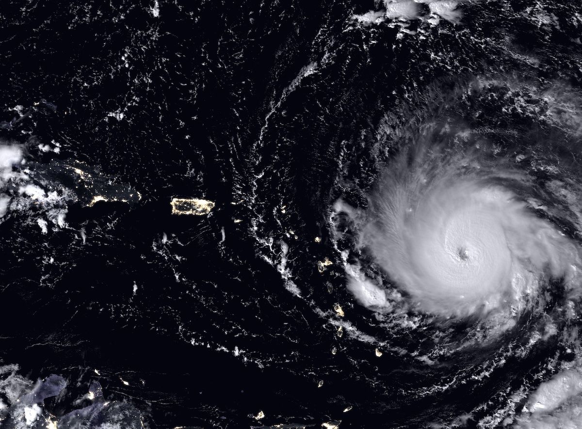
The night of 5 September 2017, photographed in the dark by a satellite that can see city lights. Irma's eye is on the right. The small scatter of lights along the bottom edge, directly in its path, is the Leeward Islands, and one of those lights is St. Martin. About a day later the eye passed over the island at Category 5.
Tell me the story
This one doesn't need dressing up, and out of respect for the people who lived it, it won't get any.
On the morning of September 6, 2017, Hurricane Irma made landfall on St. Martin at peak intensity. Category 5. Sustained winds of 180 mph. At that moment, the strongest storm ever recorded in the open Atlantic, and the first Category 5 landfall in the recorded history of the northern Leeward Islands. The eye passed directly over the island.
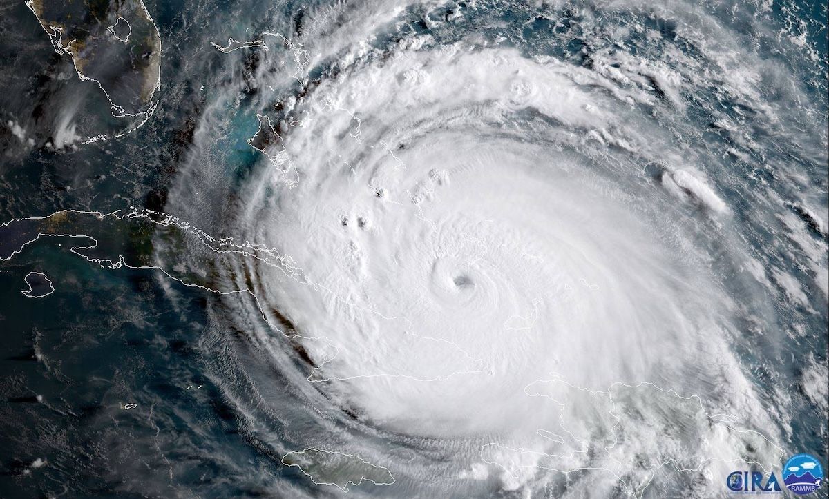
Irma, two days after St. Martin8 September 2017
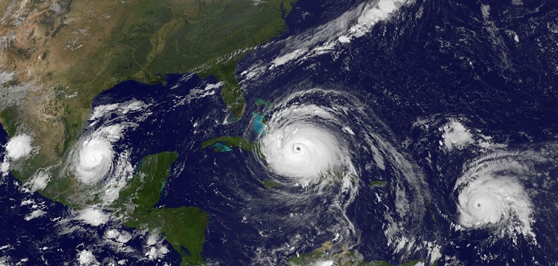
Katia, Irma and José8 September 2017
Both of these were taken on 8 September, by which time St. Martin was already two days into the aftermath. The famous pictures leave that out. The images that went around the world show Irma menacing Florida rather than hitting here. On the right, Irma sits between Katia and José, three hurricanes in the Atlantic at once, in a season that had not finished with the island yet.
The destruction
The destruction was near total. Roughly 70 to 90 percent of buildings island-wide were damaged, with about a third destroyed on the Dutch side. On the French side, the figure often cited reached 95 percent of structures damaged. Princess Juliana's terminal was gutted, jet bridges snapped like twigs. Marigot, Grand Case, Philipsburg, Maho, devastated. The storm killed 11 people on the French side and 4 on the Dutch side, injured dozens, and displaced thousands. Damage on the Dutch side alone was estimated at roughly $1.4 billion, plus comparable economic losses. That is more than a full year of the country's GDP, gone in a morning. Days of chaos and looting followed before French and Dutch military and police restored order, and while all that was happening, Hurricanes José and then Maria threatened within the same two weeks. King Willem-Alexander was on the ground within days. President Macron came to the French side.
7 September 2017
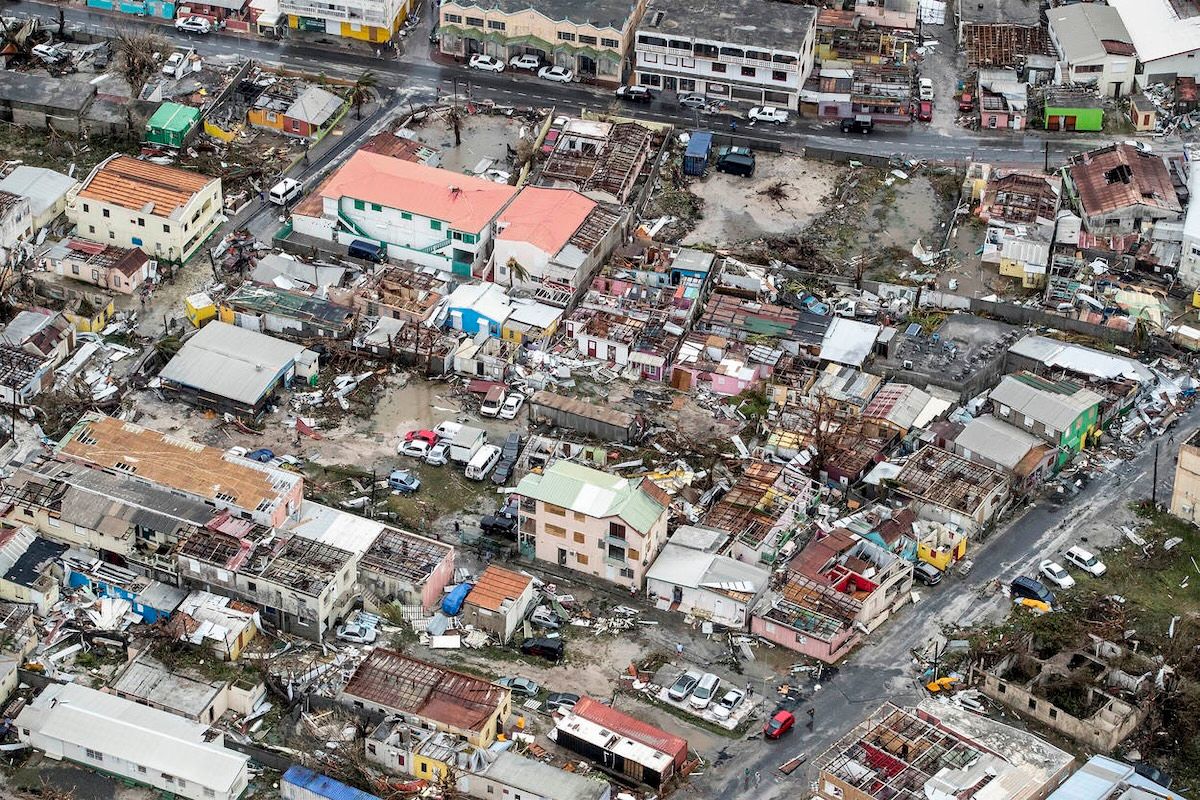
The morning after, from a Dutch military aircraft. Roofs gone in whole blocks, walls standing over nothing, cars where the wind put them. Up to 95 percent of the buildings on the island were damaged. On the street at the right of the frame, someone has already driven down it.
The island got up
And then came the part of the story to remember most: the island got up.
The recovery defined the decade that followed. The Netherlands committed 550 million euros, most of it channeled through a World Bank-managed trust fund, the Sint Maarten Reconstruction, Recovery and Resilience Trust Fund. France mounted its own major reconstruction program in the north, with a dedicated interministerial delegate. Cruise tourism came roaring back, over a million cruise passengers again in 2018, barely a year later. Hotels rebuilt in phases, with about 70 percent of the room inventory back by 2019. And the long airport terminal reconstruction, $92 million from the Trust Fund plus a $50 million European Investment Bank loan, reached its finish line on November 14, 2024, when Princess Beatrix inaugurated the completed terminal. That was almost exactly 80 years after her mother, Princess Juliana, opened the original airfield. Mother opened it, daughter reopened it.
And in the middle of all this rebuilding, the COVID-19 pandemic (2020 to 2021) hammered the tourism economy and added Dutch liquidity support, with conditions plenty of people contested, to the story. Through every bit of it, the heaviest load of the rebuilding was carried by the same people who always carry it: St. Martiners themselves, on the island and across the diaspora.
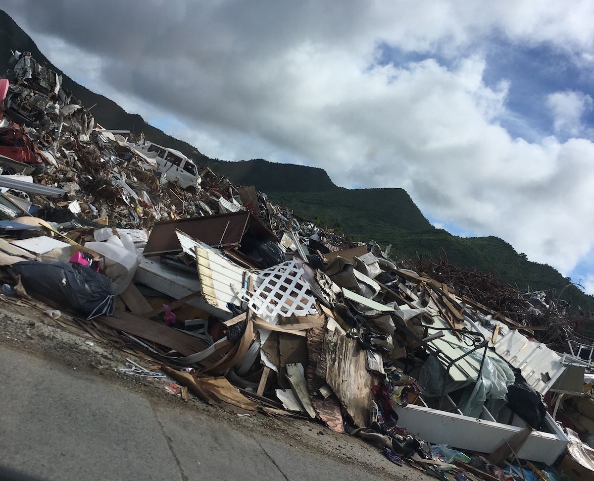
Debris at the roadside, two months later23 November 2017
St Maarten Hurricane Damage · Ellamjenks · Wikimedia Commons · CC BY-SA 4.0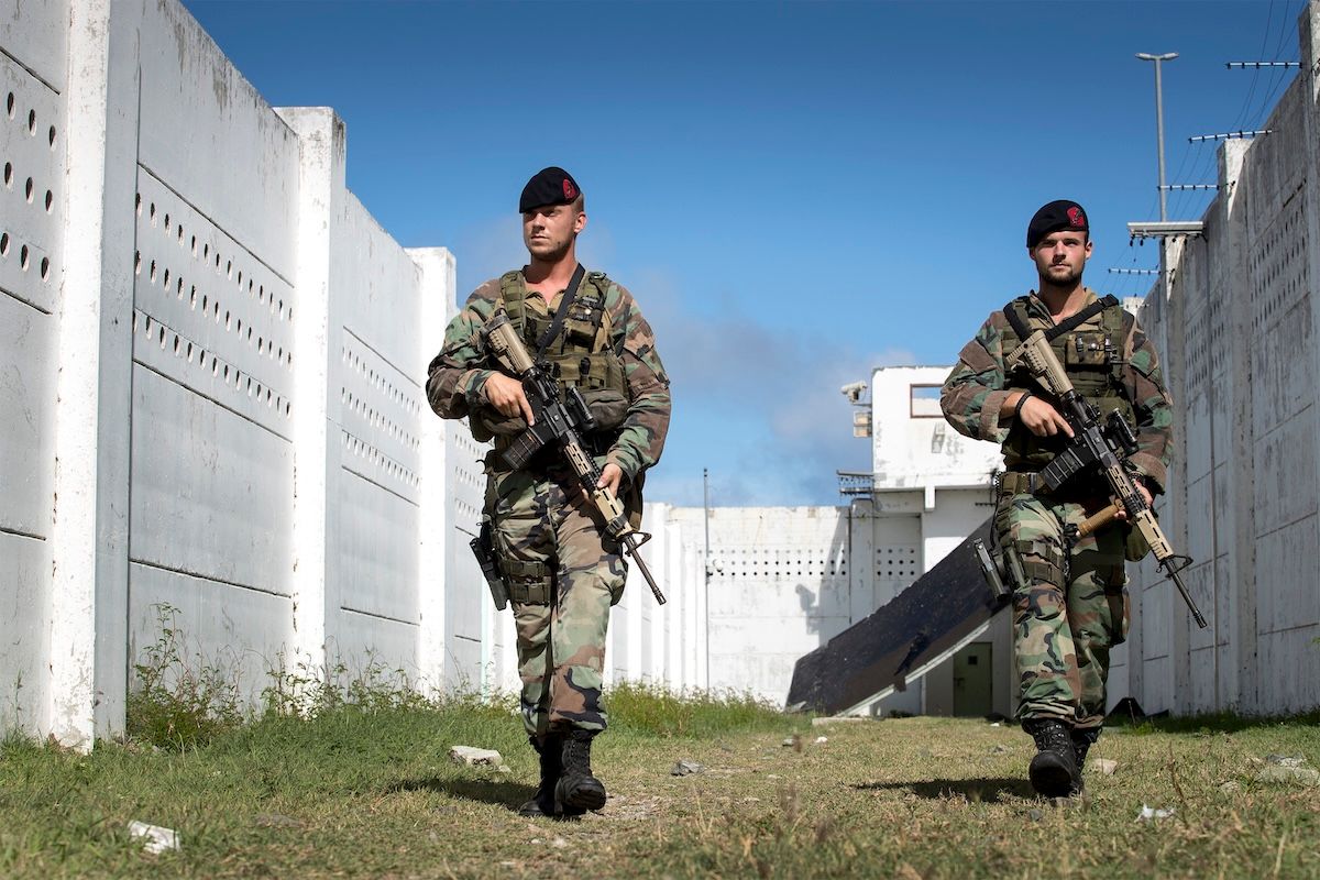
Dutch marines during the relief operation17 September 2017
Mariniers Sint Maarten Irma 2017 · Ministerie van Defensie · Ministerie van Defensie · CC BY-SA 4.0Two months on, the island was still moving itself to the roadside in piles the height of a hill. There is a gap worth naming here. The freely licensed photographs of this recovery are overwhelmingly of foreign militaries arriving, because those are the organisations that travel with photographers. That is why the rebuilding in this archive looks Dutch. The work was done by St. Martiners, over years, and it is mostly uncredited.
Go deeperCaveats, sources, and where this account is uncertain
Irma is the catastrophe against which every other event in the island's modern history is now measured. The meteorological facts are firm: landfall on the morning of September 6, 2017 at peak intensity, Category 5, sustained winds of 180 mph (285 km/h), the strongest storm recorded in the open Atlantic to that point, and the first Category 5 landfall in the recorded history of the northern Leeward Islands. The eye passed directly over the island.
The damage economics are the part most often understated. Roughly $1.4 billion in damage on the Dutch side alone, plus comparable economic losses, which together exceed a full year of GDP. The recovery that followed was correspondingly large: 550 million euros committed by the Netherlands, the bulk channeled through the World Bank-managed Sint Maarten Reconstruction, Recovery and Resilience Trust Fund, alongside a separate major French reconstruction program in the north with a dedicated interministerial delegate.
The airport terminal reconstruction is the recovery's landmark: $92 million from the Trust Fund plus a $50 million European Investment Bank loan, completed when Princess Beatrix inaugurated the terminal on November 14, 2024, almost exactly eighty years after her mother Juliana opened the original airfield.
COVID-19 struck midway through the recovery, hammering the tourism economy and adding Dutch liquidity support, on contested conditions, to the island's story.
Handle with care
- Irma's casualty count varies by source, from 11 to 15 island-wide, depending on how deaths are attributed. The breakdown most commonly given is 11 on the French side and 4 on the Dutch side, which totals 15. Lower figures generally reflect narrower attribution rather than a factual dispute.
- Building damage figures span 70 to 95 percent because they measure different things on different sides: roughly 70–90 percent damaged island-wide with about a third destroyed on the Dutch side, against the frequently cited 95 percent damaged on the French side. Any single headline percentage for the whole island is a simplification.
- "Strongest storm ever recorded in the open Atlantic" was true at the time of landfall and is stated here as of that moment.
St. Maarten and Saint-Martin Today
One island, two governments, three currencies, one people, and a movement flying a Unity Flag.
Is St. Maarten one country today?
No; the island remains two territories, Dutch Sint Maarten (a constituent country of the Kingdom of the Netherlands) and the French Collectivity of Saint-Martin, sharing an open border under the 1648 Treaty of Concordia.
2014
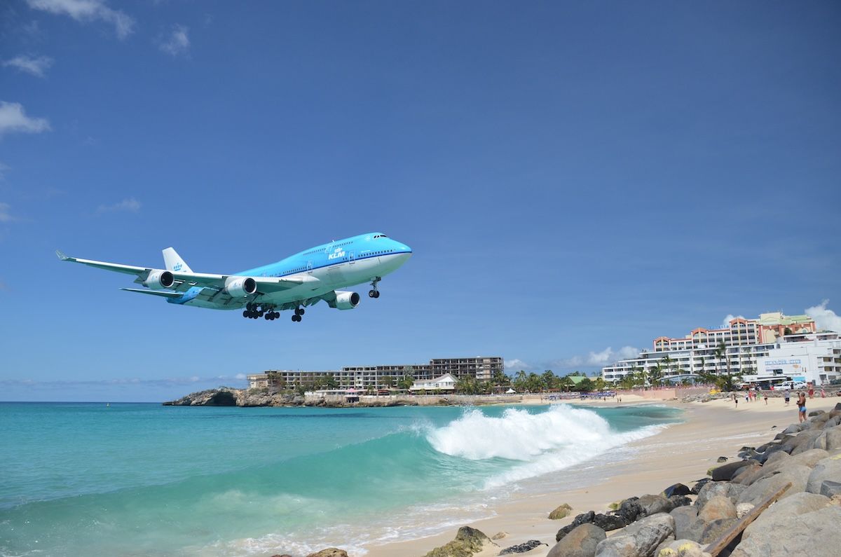
The most photographed thing on the island. The runway exists because of a war, the beach is famous because the runway is short, and the plane is landing on the Dutch side of an island whose other half is France.
Tell me the story
Which brings the story to the present.
On the Dutch side
Sint Maarten's young democracy has been turbulent. Frequent government changes since 2010, a pattern of coalition collapses that critics tie to the small 15-seat parliament and members crossing the floor. The January 2024 elections produced a four-party coalition under Prime Minister Dr. Luc Mercelina of the URSM. That government collapsed within weeks, snap elections followed in August 2024, and Mercelina came back with a second government. The Caribbean guilder entered circulation on March 31, 2025. The economy remains overwhelmingly tourism-driven: hotels, restaurants, and related services make up around 45 percent of GDP, roughly 80 percent of the workforce is connected to the sector, and cruise arrivals dominate visitor numbers. The live debates are the real ones: diversification, cost of living, integrity in governance, and that perennial St. Martin question, eventual full independence.
On the French side
The Collectivity has been led since the 2022 elections by a Territorial Council majority under President Louis Mussington of the RSM. The north wrestles with post-Irma reconstruction, high youth unemployment, and a structural mismatch that everything above explains: a French administrative system laid over an English-speaking Caribbean society. Saint-Martin shares a deputy in the French National Assembly with St. Barths (Frantz Gumbs, elected 2024) and elects a senator (Annick Pétrus).
And across both sides
There's a visible movement advocating the eventual reunification of the island, symbolized by a shared Unity Flag. It remains aspirational, because it would mean unwinding arrangements with two European states and the 1648 treaty itself. But practical unity grows every year regardless: joint disaster planning, shared institutions like an airport staffed by people from both sides, and the one holiday both sides celebrate together, St. Martin Day, November 11, honoring the spirit of Concordia and something every St. Martiner already knows: one island, one people. That feeling has a soundtrack, O Sweet Saint Martin Land, a 1958 song both sides sing as the island's own even though neither country makes it official.
The boardwalk, Philipsburg2025
St. Maarten Philipsburg Great Bay Boardwalk · Dr. Thomas Liptak · Wikimedia Commons · CC BY-SA 4.0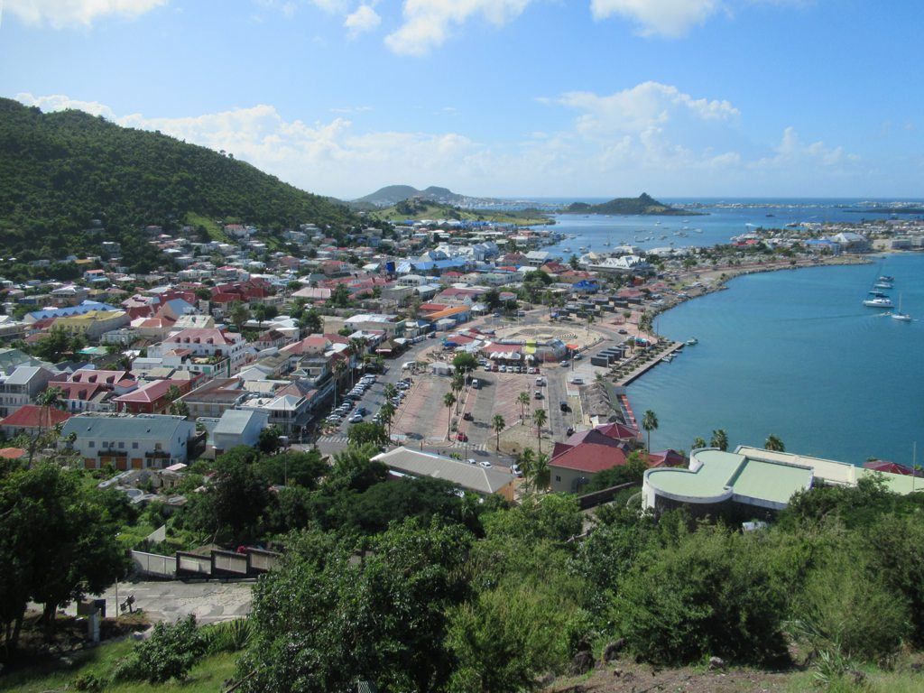

_2025_-_01.jpg)


.jpg)
_Demmeni_(Fotograaf).jpg)
.jpg)
.jpg)
.jpg)
.jpg)
.jpg)

.jpg)

_05.jpg)


.jpg)

.jpg)

Philipsburg and Marigot, half an hour apart, with no border post between them. And then the island from the water at dusk, one ridge of hills running end to end with the lights coming on along it, and no line visible anywhere on it.
Go deeperCaveats, sources, and where this account is uncertain
The structural facts of the present: Dutch Sint Maarten is a constituent country of the Kingdom of the Netherlands with a 15-seat Parliament and full internal autonomy. The French Collectivity of Saint-Martin is an overseas collectivity under Article 74 of the French Constitution and an outermost region of the European Union. The border between them remains open under the 1648 treaty.
The Dutch side's political turbulence has a commonly cited structural explanation worth stating rather than assuming: a 15-seat parliament makes coalitions fragile, and floor-crossing has repeatedly collapsed governments. The January 2024 elections produced a four-party coalition under Prime Minister Luc Mercelina (URSM) that fell within weeks; snap elections in August 2024 returned a second Mercelina government.
The economic concentration is the island's central vulnerability and its central debate: hotels, restaurants, and related services account for around 45 percent of GDP, roughly 80 percent of the workforce is connected to tourism, and cruise arrivals dominate visitor numbers. Diversification, cost of living, governance integrity, and eventual independence are the live questions.
The reunification movement, symbolized by the Unity Flag, is genuine and visible but aspirational: it would require unwinding arrangements with two European states and the 1648 treaty itself.
Handle with care
- This era describes a moving present. Government composition on the Dutch side has changed repeatedly since 2010 and the position stated here reflects the second Mercelina government formed after the August 2024 snap elections. Check the current position against the Government of Sint Maarten portal before relying on it.
- Economic shares (around 45 percent of GDP, roughly 80 percent of the workforce) are standard cited figures and move year to year.
- Island population is usually given as roughly 77,000 to 80,000 across both sides, counted by two different statistical systems.
St. Maarten History Timeline: 3300 BC to Today
The whole story on one page, in order. Every entry belongs to an era above, so follow a date back to read the story around it.
First Archaic Age peoples arrive by canoe (Norman Estate, Etang Rouge); fisher-gatherers, no pottery, no farming
Saladoid (Arawakan) farmers and potters from the Orinoco settle; Hope Estate village founded
Late Ceramic Age villages (BK76, Baie Orientale, Pointe du Canonnier, Baie Rouge); Kalinago presence from c. 1300 to 1400; the island is Soualiga, land of salt
Columbus's second voyage passes through; the name San Martín (probably first given to Nevis) ends up attached to the island; no landing, nominal Spanish claim
French settlers in the north; Dutch settle Great Bay, build Fort Amsterdam (1631), start harvesting salt
Spain captures the island, expels the settlers, fortifies Point Blanche
Peter Stuyvesant's Dutch siege fails; a Spanish cannonball takes his leg
Spain evacuates and demolishes its forts; Dutch and French rush back
Treaty of Concordia signed on Mount Concordia; the island is divided but the border stays open; one of the oldest treaties still in force anywhere
The island changes hands roughly 16 times in Europe's wars; British occupations include 1781 (Admiral Rodney) and 1810 to 1816
Philipsburg founded on the Great Bay isthmus; named for Commander John Philips (served 1735 to 1746), who revives salt and expands the plantations
Plantation peak: about 92 estates, sugar on top; enslaved Africans the large majority of the population
Philipsburg Courthouse built
Final restoration of the French-Dutch division after Napoleon; the border hasn't changed since
The entire enslaved population of three Dutch-side plantations escapes together
France abolishes slavery; the Diamond Estate 26 walk to freedom at Mount Fortune the day after the proclamation; slavery collapses in practice on the Dutch side (the UNESCO "Route to Freedom" documents)
Legal abolition finally arrives in the Dutch colonies, fifteen years late
Salt peaks (330,000+ barrels around 1850) then fades; sugar dies by c. 1875, cotton by 1932; the last commercial salt harvest is 1949
Mass emigration to the Aruba and Curaçao oil refineries; population falls from about 3,000 (1914) to about 2,000 (1940s)
The Dutch side becomes a duty-free port
WWII: Dutch side under the government-in-exile, French side under Vichy administration, U-boats in the Caribbean
Military airstrip built at Simpson Bay; opened as a civil airport by Princess Juliana on March 4, 1944
First hotels (Sea View 1947, Little Bay resort 1955); the tourism era begins
The Statuut: the Netherlands Antilles becomes an autonomous country in the Kingdom
Hurricane Donna devastates the island
The modern Princess Juliana International Airport terminal opens
Philipsburg expands onto filled-in Salt Pond land
The tourism boom under Claude Wathey; population explodes from about 5,000 to over 60,000 island-wide; the French side booms from the 1970s to 1980s
Sint Maarten becomes a separate island territory of the Netherlands Antilles
Corruption investigations and Dutch higher supervision; the Wathey era ends
Hurricane Luis (Cat 4) devastates the island; Marilyn follows within days
Hurricane Lenny hits from the west
Dutch-side referendum: about 69 percent for country status
French-side referendum: 76 percent to separate from Guadeloupe
The Collectivity of Saint-Martin is established
Ten-ten-ten: the Netherlands Antilles dissolves; Sint Maarten becomes a constituent country of the Kingdom of the Netherlands
Hurricane Irma, Category 5 at 180 mph, direct hit; up to 90 to 95 percent of buildings damaged; 15 deaths island-wide; the worst disaster in the island's history
The Great Rebuilding: 550 million euro Dutch trust fund (World Bank-managed), major French reconstruction program; cruise tourism back over 1 million passengers by 2018; COVID-19 shock 2020 to 2021
France and the Netherlands settle the Oyster Pond border question
Two Dutch-side general elections; the Mercelina governments; Nov 14: Princess Beatrix inaugurates the rebuilt airport terminal, 80 years after Juliana opened the original
The Caribbean guilder enters circulation, replacing the Netherlands Antillean guilder
The Culture: Language, Food, Festivals, and Heritage Sites
Dates alone tell you very little about how a place actually lives. This part does.
The language
The St. Martiner's native language is English, not Dutch and not French. It's a distinctive local English with deep Caribbean roots, going back to the 18th-century waves of English-speaking settlers and enslaved people and reinforced by centuries of trade and migration. Dutch and French are the official state languages of their respective sides, but the street speaks English first, alongside Creole, Spanish, French, Dutch, and Papiamento. That gap between the official language and the lived one is a major theme in the island's modern politics and education debates, explored in scholarship like Rhoda Arrindell's Language, Culture, and Identity in St. Martin.
Traditions born from the salt and the struggle
The Ponum dance, danced to commemorate emancipation itself. String band and traditional folk music. Anansi stories. A culinary canon of johnnycakes, salt fish, conch and dumplings, callaloo, bush tea, and dishes carrying the flavors of every community that ever landed here. And guavaberry liqueur, the island's signature drink, made from rare local guavaberries steeped in rum and traditionally poured during Christmas and New Year serenading.
The island's song
Almost everyone here knows O Sweet Saint Martin Land, written in 1958 by Father Gerard Kemps, a Dutch priest posted to the French-side parish. Formally, La Marseillaise is the anthem on the French side and Het Wilhelmus on the Dutch side, but Kemps's song is the one the whole island claims as its own, sung across the border at schools, ceremonies, and St. Martin Day. Read the full story of the anthem.
The festivals
Carnival, and the island does it twice: the Dutch side's Carnival around April, ending with the Grand Parade and the burning of King Momo, and the French side's Carnival in the traditional pre-Lenten season. St. Martin Day on November 11 unites both sides. Emancipation Day (July 1, Dutch side) and Abolition Day (May 28, French side) honor the ancestors. Grand Case's Harmony Nights and the island's well-earned title of Culinary Capital of the Caribbean carry the culture through food.
Letters and arts
For an island this size, the creative output is remarkable. House of Nehesi Publishers and poet-publisher Lasana M. Sekou have made St. Martin a genuine center of Caribbean literature. Painters like Sir Roland Richardson, the father of Caribbean impressionism, and Ruby Bute. Historians and educators like Daniella Jeffry and Will Johnson, plus the researchers of the National Heritage Foundation, Les Fruits de Mer, SIMARC, and the Association Archéologique Hope Estate, who keep the record alive. Even Nobel laureate Derek Walcott had St. Martin family roots.
Places where you can touch this story
All of them are still standing, and you can visit every one.
Fort Amsterdam
Built 1631. The first Dutch military fort in the Caribbean, on the peninsula between Great Bay and Little Bay. Now also home to a protected brown pelican colony.
The Old Spanish Fort
Point Blanche. Built during the Spanish occupation after 1633, when the island was Spain's most important stronghold east of Puerto Rico.
Fort Louis
Above Marigot. Batteries from around 1765, the full fort by 1789, built to protect the growing port's warehouses.
Fort Willem
Above Philipsburg. Started by the British in 1801 and taken over by the Dutch in 1816, the year the border settled for good.
The Philipsburg Courthouse
Built 1793. Still the most iconic building on the island.
The Border Monument
The obelisk on the Marigot road, raised in 1948 for the Treaty of Concordia's 300th anniversary. The agreement it marks predates the United States by more than a century.
The One Tété Lohkay statue
On the roundabout at the foot of Sucker Garden Road. The island's most beloved symbol of resistance, honoring an enslaved woman who escaped, was mutilated for it, and escaped again.
The Salt Pickers and Emancipation monuments
At the Great Salt Pond and in Philipsburg. For the people who did the island's most brutal work, and for the people who walked away from it into freedom.
The synagogue ruins
Behind the Guavaberry Emporium on Front Street. Left by the Jewish merchant community that flourished in Philipsburg's plantation-era prosperity and abandoned around 1800. Most people walk past without noticing.
The Sint Maarten Museum
Philipsburg. Holds cargo recovered from a British warship that sank off the coast in 1801, among much else.
The Marigot museum's pre-Columbian collection
French side. Where the artifacts of the island's first 5,000 years are on display.
Loterie Farm
On the French slopes of Pic Paradis. A former plantation estate, and one of the estate names still on the map.
The Emilio Wilson Estate
Cul-de-Sac. Formerly the Golden Rock and Industry plantations. Now an estate and park.
Hope Estate, Norman Estate, and Baie Rouge
The Amerindian sites. Hope Estate is one of the earliest Ceramic Age villages in the entire Lesser Antilles; Norman Estate was the first pre-ceramic site ever found on the island.
Go deeper
Long-form pieces on the island's culture and identity, each one its own full story.
Sources and Further Reading
Good history shows its work. This account synthesizes academic archaeology, treaty texts, UNESCO records, government and institutional histories, and reputable island heritage sources. To go deeper, start here.
The images show their work too. Every picture on this page is credited in full, with its creator, date, archive, and licence.
Pre-Columbian archaeology
- Hofman, C.L. & Hoogland, M.L.P. (eds.), Archaeological Investigations on St. Martin (Lesser Antilles): The Sites of Norman Estate, Anse des Pères and Hope Estate, Leiden University (1999)
- Serrand, N. & Bonnissent, D., "Interacting Pre-Columbian Amerindian Societies and Environments: Insights from Five Millennia of Archaeological Invertebrate Record on the Saint-Martin Island," Environmental Archaeology (2018)
- Leiden University, Caribbean archaeology research
- SIMARC (Sint Maarten Archaeological Center), led by Dr. Jay Haviser
Colonial era and the Treaty of Concordia
- Henocq, C., "Concordia Treaty, 23rd March 1648," Heritage magazine (2010), with the treaty text and commentary
- Hartog, J., History of Sint Maarten and Saint Martin, the standard Dutch-side academic histories
- Nationaal Archief (Netherlands): Dutch West India Company records
- Standard references: "Treaty of Concordia," "Attack on Saint Martin (1644)," "History of Saint Martin," "Sint Maarten," "Collectivity of Saint Martin," "Philipsburg," and the sources cited within them
- Vacation St. Maarten / Visit St. Maarten heritage pages (official tourism authorities)
Slavery and emancipation
- UNESCO Memory of the World, "Route to Freedom: A case study of how enslaved Africans gained their freedom on the dual national island of Sint Maarten (Saint Martin)" (inscribed 2017)
- Nationaal Archief (Netherlands): the digitized 1863 emancipation registers for the Dutch Caribbean
- Sint Maarten Museum, "Slavery and Emancipation"
- St. Maarten National Heritage Foundation
The modern era
- Government of Sint Maarten, "Sint Maarten: 15 Years of Constitutional Autonomy" (2025)
- Collectivité de Saint-Martin, official portal
- Standard references: "Dissolution of the Netherlands Antilles," "2000 Sint Maarten status referendum," "January/August 2024 Sint Maarten general election"
- World Bank, Sint Maarten country page
- Sint Maarten Reconstruction, Recovery and Resilience Trust Fund (World Bank-managed)
- NOAA National Hurricane Center, Tropical Cyclone Report: Hurricane Irma (2017), and NHC records on Donna, Luis, and Lenny
- "Recovery of the Island of Saint Martin after Hurricane Irma," MDPI (2020)
- The Daily Herald, Faxinfo, and SMN News for 2024 to 2025 events (the airport reopening, the elections, the Caribbean guilder)
Culture and identity
- Arrindell, R., Language, Culture, and Identity in St. Martin, House of Nehesi (2014)
- Jeffry, D., 1963: A Landmark Year in St. Martin and related works
- Sekou, L.M. and the House of Nehesi Publishers catalog
- Klomp, A., "Saint Martin: Communal Identities on a Divided Caribbean Island," Journal of European Ethnology (2000)
That's the story of Soualiga. Five thousand years, two flags, one people, and an island that has been flattened more than once and rebuilt every time.
Sweet St. Martin land.