Skip to content
This Is SXM

One people · One island · One destiny

Live now
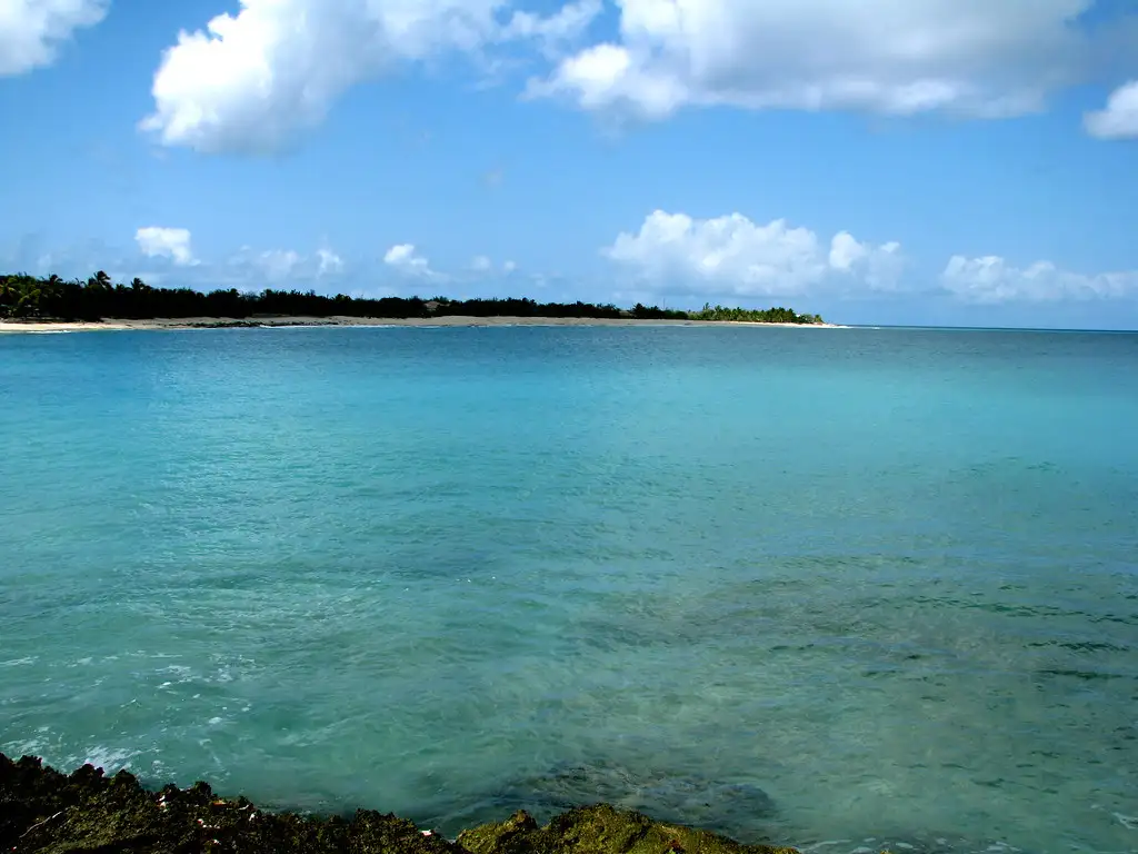
Empty pale sand curving between low green headlands at Baie aux Prunes, with clear turquoise water and nobody on the beach

Baie aux Prunes

Baie aux Prunes

French side
  • Secluded
  • Sunset
  • Surfing

Fine, white to golden. A small free lot at the top of the path, at the bay's single public access point at the north end. Then a short sand path down between the villas. Short walk in. No fee.

Getting in
Short walk
Parking
Free lot. A small free lot at the top of the path. French Wikipedia records a single public access point for this bay, at the north end. Every source calls the parking small and nobody has counted it. It is unattended and surrounded by nothing. No break-in reports surfaced, which given how few people come here is not much of a signal either way. Access is through the Terres Basses estate and its security checkpoint, where visitors describe saying they are going to the beach and being let through.
Water
Varies
Snorkeling
Fair
Shade
Some natural shade
Chairs
No chair rental
Food on site
Nothing on site
Restrooms
None
Facilities
Natural shade. No chairs and umbrellas, restrooms, snacks and drinks, showers, or lifeguard
On a ship day
Low
Crowds
Quiet
Best time
Late afternoon into sunset. This is the only Terres Basses beach facing directly west, and it holds the sun later than Baie Rouge, which loses it behind its own cliffs.
Best for
Sunset, quiet, or surf
Safety
Rocks are what visitors keep warning about, in 2017 and again in 2026, and specifically when the surf is up. This beach faces due west, is unprotected by reef, and picks up Caribbean and refracted north swell, so it is calm on flat days and a surf beach on swell days with no signage, no flag and no lifeguard to tell you which one you are looking at. A nearshore sandbank generates the waves surfers come for, and a wave-producing bank on a west-facing beach with no reef is the standard recipe for a dumping shorebreak, though nobody has published a measured account of it here. Rip currents are undocumented for this beach and plausible on swell days, which is inference rather than evidence. Rescue access is poor: no lifeguard, no rescue post, no vendors, few other people, a footpath rather than a road to the sand, and a private estate between the beach and the main road. On a quiet weekday there may be nobody to see it if you get into trouble.

The story

Baie aux Prunes is 1,130 metres of sand on the west side of the Terres Basses with no bar, no chairs, no toilets, no vendors and no bus. It is the only one of the three main Terres Basses beaches facing directly west, which makes it the sunset one, and the same open aspect makes it one of the few named surf spots on the French side. Both of those come from the same geography, and so does the hazard.

Checked: August 2026 · Reported

The sunset beach, and the geography that makes it one

Baie aux Prunes faces due west. Baie Rouge faces northwest and loses the sun behind its own cliffs; Baie Longue faces southwest. This is the one people name for sunset, and a July 2023 visitor called it the best sunset on the island.

The western exposure also means the beach holds sun later in the day, which is worth knowing if you are planning an afternoon rather than a morning.

The practical version: Baie Rouge is the beach you photograph, Baie aux Prunes is the beach you sit on until the sun goes down, and neither has anywhere to buy a drink. Bring one, and bring a torch for the walk back up the sand path.

A rock outcrop at the end of the beach at Baie aux Prunes, shaped a little like a whale's head, with the sea beyond
The rock outcrop at one end of the bay, July 2008. The rocky ends are where the snorkeling is, and where the danger is when there is surf running.Rennett StoweFlickrCC BY 2.0

The same swell that makes it a surf spot makes it a hazard

Baie aux Prunes is one of the few named surf spots on the French side. Petit Futé says it attracts surfers in swell weather, and one older French-language island site explains the mechanism: waves generated by a sandbank near the shore, ridden by surfers and bodyboarders.

That sandbank is also why visitors keep describing the beach as dangerous when the surf is rough, and why the rocky sections at the ends stop being a curiosity and become a hazard. A March 2026 visitor: there are stones and it can be dangerous. A February 2017 visitor: the shore is a bit rocky, which can be dangerous if the surf is rough.

Some sources call this beach calm and good for swimming and snorkeling, and on a flat day they are right. The reconciliation is simple and it is worth saying plainly rather than as a disclaimer at the bottom: the surf and the danger are the same fact.

Snorkeling, when it is calm, is along the rocks at the ends of the bay and it is modest. One visitor found a few fish along the rocks; another called it a bit disappointing. This is not inside the Réserve Naturelle, so there is no protected status and no monitoring. Baie Rouge's arch and Trou de David are the better snorkel targets in this area.

Black and white view of storm clouds massing over a rocky stretch of beach with driftwood in the foreground
Storm light over the bay in June 2012. This is the other version of Baie aux Prunes, the one the calm-and-safe descriptions leave out.Rennett StoweFlickrCC BY 2.0

One access point at the north, and a 1963 rule that explains why

French Wikipedia records that Baie aux Prunes has a single public access, at the north end of the bay. The same is true of Baie Longue, at the centre, and Baie Rouge, at the east.

That pattern comes from how the Terres Basses was planned. A 1963 rule set a minimum lot size of one hectare, restricted use to residential with the exception of seasonal rentals and the La Samanna hotel, and banned condominiums and subdivision. That claim comes from a rental agency and is unverified against the underlying document, but it is specific enough to be worth repeating with that caveat, and it explains what you find: very few landowners holding very large beachfront parcels, private internal roads, and public access surviving only at designated points.

The beach is public. The way to it mostly is not.

Getting here: about 15 to 20 minutes from Marigot southwest through Sandy Ground and Baie Nettlé, or 40 to 50 minutes from Philipsburg up the Dutch side through Maho and Cupecoy and across into the Lowlands. Once inside the estate, the instruction forum regulars used was to take the Baie Rouge entrance and continue straight ahead rather than turning left for Baie Longue, though those reports are 11 to 13 years old so the specific turn wants checking on the ground. The last stretch is a private road and then a short sand path down between the villas. There is no bus into Terres Basses at all.

Villas standing on the slope above a quiet bay with aquamarine water below them
The villas above the bay in July 2008. This is the estate you drive through and the reason public access here comes down to a single point.Rennett StoweFlickrCC BY 2.0

It is genuinely empty, and that is the whole product

No toilets, no showers, no bar, no restaurant, no chairs, no umbrellas, no vendors. Bring water, food, shade and everything else. The nearest food is outside Terres Basses entirely: Baie Nettlé or Marigot going north, Cupecoy or Maho going south.

Visitors from 2016 through 2026 describe very few people. Petit Futé puts the emptiness down to the beach simply not being well known.

That is worth stating plainly, because it is a real trade-off rather than a selling point dressed as one. You get the beach to yourself and you get nothing else, including help if something goes wrong.

On the length: 1,130 metres, from the French Wikipedia measured inventory. A travel agency blog independently cites the same figure, which suggests it comes from a common official or cadastral origin rather than from someone's estimate. That is a better-evidenced number than most beach lengths on this island.

Common questions

Quick fact

Is Plum Bay open to the public?

Yes. The beach is public and has a designated public access point at the north end. You reach it by driving through the Terres Basses residential estate, past a security checkpoint where you say you are going to the beach, then walking a short sand path down between the villas.

Quick fact

Are there any facilities, food or chair rentals at Plum Bay?

None at all. No toilets, no showers, no bar, no restaurant, no chairs, no umbrellas, no vendors. Bring water, food and shade. The nearest food is outside Terres Basses: Baie Nettlé or Marigot going north, Cupecoy or Maho going south.

Quick fact

Can you surf at Plum Bay?

Yes, when there is swell. It is one of the few named surf spots on the French side, with waves generated by a sandbank near the shore, and it draws surfers and bodyboarders on swell days. There is no surf shop, no rental and no lifeguard, so bring your own board and your own judgement.

Quick fact

Is Plum Bay good for sunset?

It is the best of the Terres Basses beaches for it, because it is the only one facing directly west. Bring a torch for the walk back up the sand path, and leave before the estate feels unwelcoming after dark.

Quick fact

Is Plum Bay safe for swimming?

On flat days, yes, for confident swimmers. On swell days it is a surf beach with rocks, and visitors in both 2017 and 2026 specifically warn that the rocky sections become dangerous when the surf is rough. There is no lifeguard and very few other people.


Keep planning

Where this fits


Sources

Where this comes from

Last checked August 17, 2026. Everything on this page is confidence reported: drawn from credible sources but not independently confirmed by us. Beach conditions change with the weather and the season, and businesses on the sand open and close, so check anything you are building a day around.

Stay posted

Get the week ahead on SXM

Ships in port, what's on, and island conditions for the week ahead. Every Monday. A couple of minutes to read, unsubscribe anytime.